August 9, 2013

The Pros and Cons of South West Solar Farming

Generalising some points initially raised in another conversation, what are the advantages and disadvantages of large scale solar photovoltaic installations on farms in South West England? According to the planning application submitted earlier this month by the developer of one such site the advantages are:

This solar development will have a generation capacity of approximately 5.73 megawatts (MW), which is enough to power 1790 typical homes, and save approximately 3 million kg in CO2 emissions per annum – the equivalent of removing 670 standard cars from the road each year.

The  developer doesn't mention the disadvantages of course, so I'll start that ball rolling. According to the same planning application:

The application area is 13.34ha in size being formed of two adjacent fields…. The site is classified as Agricultural Land Grade 2.

Starting with planning issues, it seems everybody one asks these days, from the NFU to the Solar Trade Association to the minister at DECC agrees this sort of thing is a bad idea, although they're not always very clear about why that is. Here's my perspective. The UK currently imports nearly 40% of the food we consume. Particularly with climate change now affecting food production both locally and globally, why should the citizens of the UK pay over the odds to turn some of the limited supply of land capable of growing their daily bread over to energy production? In fact why not save money by reducing the nation's energy consumption instead?

Moving on to technical issues, it seems some solar developers don't even understand the difference between a MW and a MWh! Do you suppose that they understand that large parts of the electricity distribution grid in South West England are already incapable of absorbing any more renewable electricity generation due to "over voltage" and/or "thermal overload" constraints?

Filed under Renewables by

August 5, 2013

Lightsource Make Second Application for Bowhay Farm Solar Park

Earlier this year Lightsource Renewable Energy withdrew their application to construct a  54 acre, 10.7 MW solar photovoltaic park at Bowhay Farm between Dunchideock and Ide in Devon. However they have now applied for permission to construct a somewhat smaller scheme on the same site. According to the design and access statement that has just appeared on the Teignbridge District Council web site :

The application area is 13.34ha in size being formed of two adjacent fields. It is proposed to install solar modules covering approximately 4.18ha. The reason the proposed solar panels and associated infrastructure will cover only 31.3% of the site is that sufficient gaps must be provided between the rows of panels, to avoid one row shading another, and sufficient setbacks need to be provided from boundary vegetation, particularly on the southern boundary to avoid shading. The design of the proposed Layout Plan has been prepared to maximise energy production within the available area of land, taking into account the site specific constraints.

The purpose of the development is to convert daylight into electricity. This solar development will have a generation capacity of approximately 5.73 megawatts (MW), which is enough to power 1790 typical homes, and save approximately 3 million kg in CO2 emissions per annum – the equivalent of removing 670 standard cars from the road each year.

This application is a reduced proposal to that originally submitted in October 2012 (subsequently withdrawn January 2013). Key changes include a reduced size (10.7MW to 5.7MW, a reduction of three fields to two) and a reduction in the height of the panels from 2.4m above ground to 1.54m above ground.

More on Lightsource Make Second Application for Bowhay Farm Solar Park

Filed under Renewables by

July 27, 2013

Arctic Voyages 2013 – Update 1

Although their "Trip Tracker" doesn't reflect this as yet, the Mainstream Last First expedition have just reported on their Facebook page that the Arctic Joule is currently:

Beached at Dew Line Station under the Arctic eagle's watch

at Cape Parry. They've also posted a picture of themselves rowing in the Arctic twilight:

Paul Gleeson and Denis Barnett rowing through the Arctic twilight

Paul Gleeson and Denis Barnett rowing through the Arctic twilight

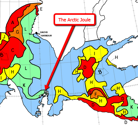
The satellites' view of their location is currently hidden by clouds, but here's the Canadian Ice Service's view of the sea ice in their vicinity:

The state of the Amundsen Gulf sea ice forecast on July 26th 2013

The state of the Amundsen Gulf sea ice on July 26th 2013

Although the water immediately in front of them currently contains little ice, slightly further ahead their way is blocked by 90% concentration ice over 1.2 metres thick. As the map shows, the recent cyclone in the Arctic is still generating westerly winds which are causing the sea ice near the Arctic Joule to drift in an easterly direction at around 8 nautical miles per day. It looks like the route will be blocked for a while yet.

Meanwhile Séb and Vincent report from Babouchka that:

We are fast approaching the 75th parallel, the symbolic marking of the beginning of a more favourable terrain, where the waterways will be much rarer. Already the ice sheets do not have the same look, while they were brown and battered to the south, they are now mostly very white and rather thin. Finally we've got a bit of sun that has allowed us to dry our clothes and sleeping bags!

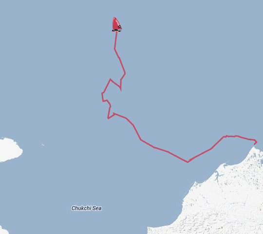
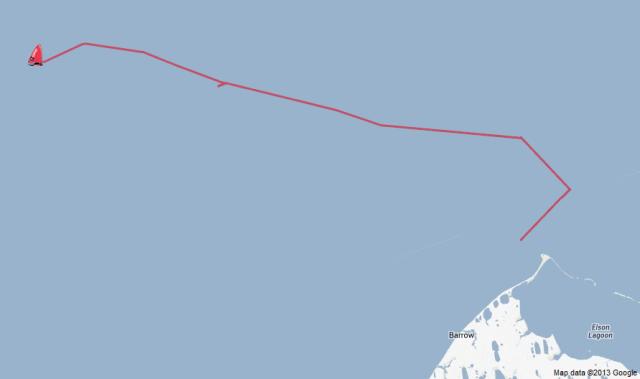
Here's the course they have steered thus far, over a total of nearly 1,000 km:

Babouchka's progress by July 27th 2013

Babouchka's progress by July 27th 2013, with north at the top.

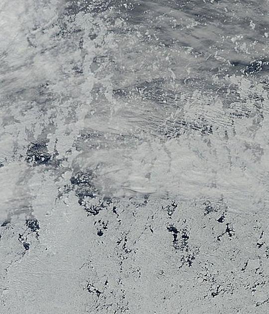
The glimpse of sun they mentioned means the satellites can just about make out the Chukchi Sea from space, through some hazy clouds. Here's what Terra can see, courtesy of Arctic.io:

The Chukchi Sea on July 27th 2013

The Chukchi Sea on July 27th 2013, with north at the bottom!

The Babouchka is roughly in the middle of that picture on the edge of the main pack of sea ice, which is currently looking rather battered in the wake of the cyclone.  Babouchka is designed to travel over ice, unlike the Arctic Joule, but it looks as though the ride will be bumpy for quite some time to come.

Filed under Climate by

July 24, 2013

Tropical Storm Dorian is Born Near Africa

After commenting on the "quiet start" to the 2013 Atlantic Hurricane season only a few days ago, I can now report that things are warming up off the west coast of North Africa. The first two tropical storms of the Atlantic season were born over in the Gulf of Mexico and the Caribbean. The third started in the central Atlantic. The fourth is called Dorian, and earlier this morning the National Hurricane Centre announced that the:

FOURTH NAMED STORM OF THE 2013 SEASON FORMS… SATELLITE IMAGERY AND DATA INDICATE THAT THE TROPICAL DEPRESSION IN THE EASTERN TROPICAL ATLANTIC HAS STRENGTHENED THIS MORNING.

AT 1100 AM EDT…1500 UTC…THE CENTER OF TROPICAL STORM DORIAN WAS LOCATED NEAR LATITUDE 14.3 NORTH…LONGITUDE 29.9 WEST. DORIAN IS MOVING TOWARD THE WEST-NORTHWEST NEAR 21 MPH…33 KM/H…AND THIS GENERAL MOTION IS EXPECTED TO CONTINUE DURING THE NEXT COUPLE OF DAYS.

MAXIMUM SUSTAINED WINDS ARE NEAR 50 MPH…85 KM/H…WITH HIGHER GUSTS. SOME SLIGHT STRENGTHENING IS POSSIBLE TODAY…FOLLOWED BY GRADUAL WEAKENING ON THURSDAY AS DORIAN MOVES OVER COOLER WATER.

TROPICAL-STORM-FORCE WINDS EXTEND OUTWARD UP TO 45 MILES…75 KM FROM THE CENTER. THE ESTIMATED MINIMUM CENTRAL PRESSURE IS 1002 MB…29.59 INCHES.

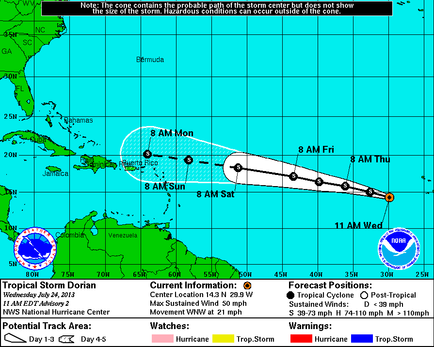
Here's Dorian's projected path over the next 5 days:

NHC forecast track for Tropical Storm Dorian at 11:00 EDT on Wednesday July 24, 2013

NHC forecast track for Tropical Storm Dorian at 11:00 EDT on Wednesday July 24, 2013

Currently the NHC advise that:

HAZARDS AFFECTING LAND
———————-
NONE.

Filed under Climate by

July 23, 2013

The Approaching Storm in the Beaufort Sea

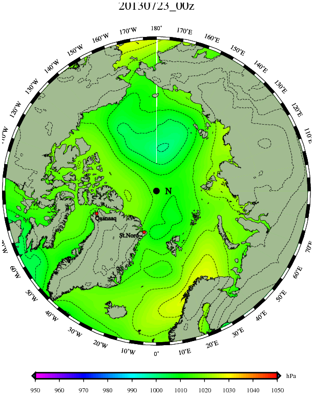
We've been following the approaching cyclone in the Arctic for a few days, and this morning the predictions are starting to come true. Out of all the various forecasting models we've looked at so far only ECMWF offers a "nowcast". That's the model's idea of what's happening in real time in the real world, and here's how it looked over the Arctic first thing this morning, as visualised by the Danish Meteorological Institute:

The Danish Meteorological Institute's surface pressure chart for July 23rd 2013

The Danish Meteorological Institute's surface pressure chart for July 23rd 2013

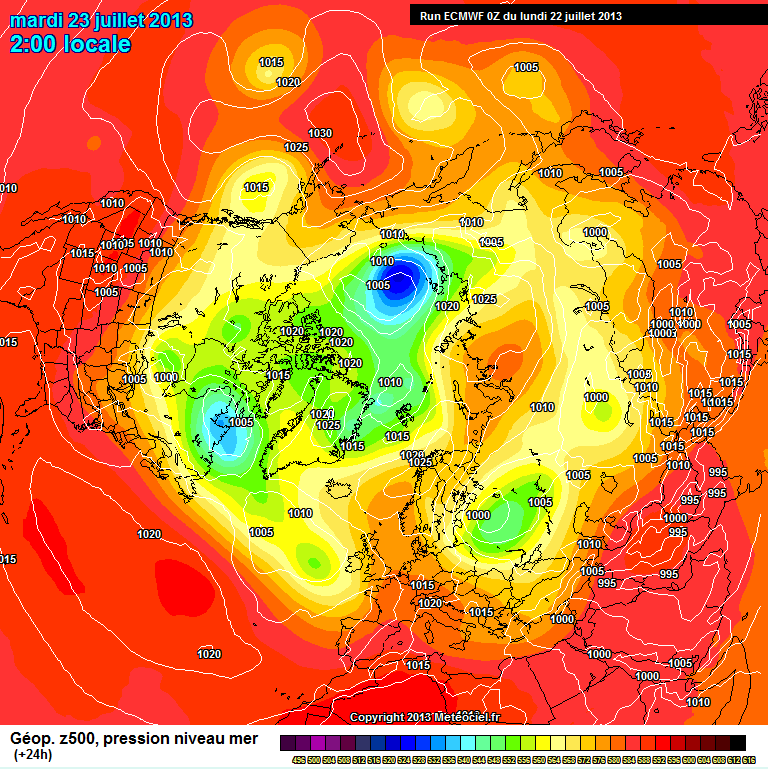
Apart from being zoomed in on the Arctic the isobars don't look too different to yesterday's ECMWF forecast for this morning, available from the MeteoCiel archives:

ECMWF SLP forecast for July 23rd 2013 from the July 22nd model run

ECMWF SLP forecast for July 23rd 2013 from the July 22nd model run

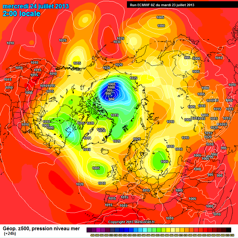
That should give us some confidence that the ECMWF model's prediction for midnight tonight GMT will come to pass:

ECMWF SLP forecast for July 24th 2013 from the July 23rd model run

ECMWF SLP forecast for July 24th 2013 from the July 23rd model run

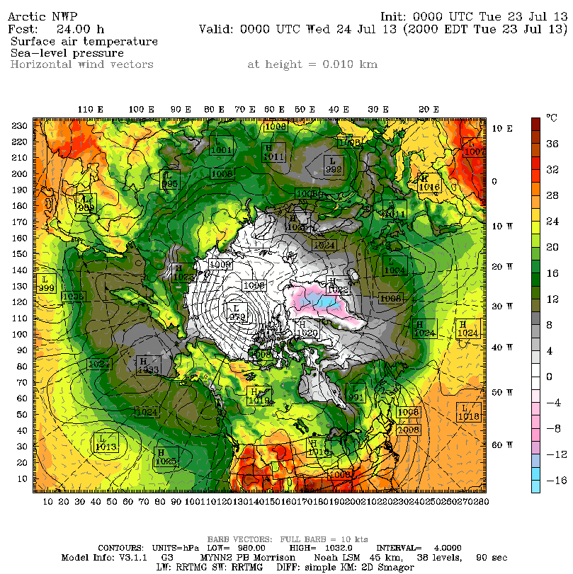
What is likely to be of most concern to the members of the two teams currently in small boats in the Arctic is, however, the wind speeds near the surface rather than the atmospheric pressure, and the effect those winds have on the ice. That information is a bit harder to come by. Obviously if you want to model what's going to happen to sea ice in the Arctic you need to model what's going to happen to the atmosphere just above the ice. The US Navy's NAVGEM model does just that, but the output is a bit hard to read when the isobars get packed closely together as they're predicted to do over the next 24 hours or so. However as luck would have it the ECMWF recently received a presentation on yet another forecasting model, called Polar WRF. This model has been specially designed to work better in the polar regions than more general purpose atmospheric models, and here is its forecast for midnight tonight:

Polar WRF SLP/Wind forecast for July 24th 2013 from the July 22nd model run

Polar WRF SLP/Wind forecast for July 24th 2013 from the July 22nd model run

It's still rather hard to read, but hopefully if you click on the image above you will just about be able to make out all the little arrows with 2 or 3 "barbs" clustering around the cyclone which has a predicted central pressure of 979 millibars.

After all these assorted predictions you may well be wondering exactly what's happening at sea (or ice) level in the Beaufort Sea. As more luck would have it the webcam we showed you a couple of days ago is mounted on the same floating buoy as a weather station, which reports that the pressure is indeed dropping whilst the wind is rising:

O-Buoy 8 reports on the weather in the Beaufort Sea on July 23rd 2013

O-Buoy 8 reports on the weather in the Beaufort Sea on July 23rd 2013

The waters of the Beaufort Sea are starting to look slightly agitated:

Image of the Beaufort Sea from O-Buoy 8 on the morning of July 23rd 2013

Image of the Beaufort Sea from O-Buoy 8 on the morning of July 23rd 2013

Filed under Climate by

July 21, 2013

A Storm is Brewing in the Arctic

Here at econnexus.org.uk we're used to tracking hurricanes, but so far there's been a fairly quiet start to the 2013 Atlantic hurricane season. The strongest tropical storm so far has been Andrea, whose winds reached a maximum speed of 65 mph (100 km/h) around a minimum central pressure of 992 mbar. The National Hurricane Centre currently reports "No tropical cyclones at this time" for both the Eastern Pacific and the North Atlantic. Despite that an "extra-tropical" cyclone looks like it's on its way next week, far to the north of both those oceans.

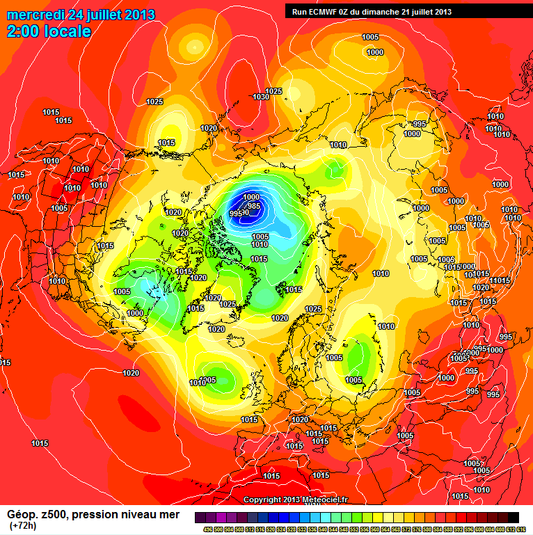
Last Friday I was perusing some weather maps of the Arctic, trying to work out when there might be any change in the persistent northeasterly winds that have been hindering the progress of The Arctic Joule as its crew of four attempt to row through the Northwest Passage from west to east. I found myself looking at this surface level pressure chart on German weather site WetterZentrale:

ECMWF SLP forecast for July 24th 2013 from July 19th model run

ECMWF SLP forecast for July 24th 2013 from the July 19th model run

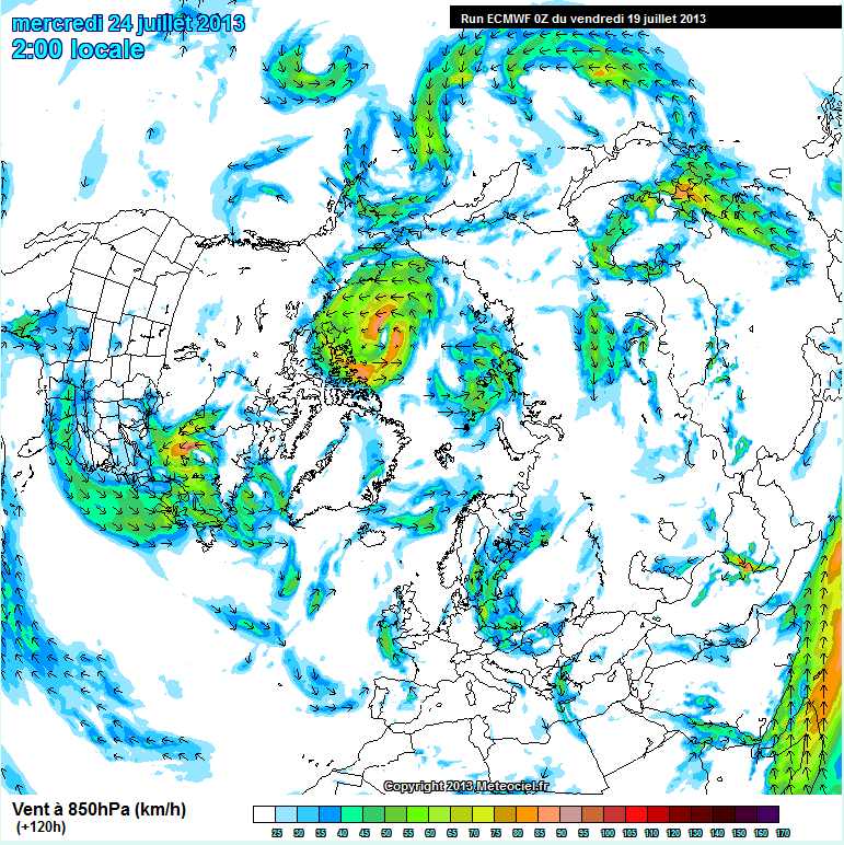
If you click on the image then look closely at the centre of the green area you can just make out in amongst the tightly packed isobars of a large cyclone a predicted central pressure of less than 980 mbar, which is a lot lower than Andrea managed to achieve earlier this year. That certainly looks like it will put some strong winds behind the Arctic Joule next week, and promises even stronger winds for the crew of the other Arctic expedition we are following at the moment – Séb Roubinet and Vincent Berthet who are attempting to sail their catamaran Babouchka over both sea and ice right across the Arctic Ocean. To find a wind forecast I switched to French weather site MeteoCiel which seemed entirely appropriate in the circumstances. There I found this forecast:

ECMWF Northern hemisphere wind forecast for July 24th 2013, based on the July  19th model run

ECMWF Northern hemisphere wind forecast for July 24th 2013, based on the July 19th model run

That shows a maximum wind speed of over 90 km/h, although thankfully that's over the northern Beaufort Sea rather than Babouchka's current location in the southern Chukchi Sea.

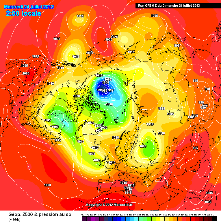
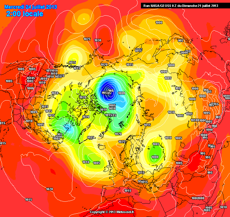
Regular readers will recall that during Hurricane Sandy last year the American GFS forecast model was predicting a very different track for Sandy than the European ECMWF model, so today I've been comparing forecasts for the Arctic once again. This time it seems the various models are all in agreement that this Arctic cyclone will happen, although the fine details are slightly different. Here are three of today's forecasts for next Wednesday, once again courtesy of MeteoCiel:

ECMWF SLP forecast for July 24th 2013 from the July 21st model run

ECMWF SLP forecast for July 24th 2013 from the July 21st model run

GFS SLP forecast for July 24th 2013 from the July 21st model run

GFS SLP forecast for July 24th 2013 from the July 21st model run

NASA GOES 5 SLP forecast for July 24th 2013 from the July 21st model run

NASA GOES 5 SLP forecast for July 24th 2013 from the July 21st model run

One big question now is exactly how strong will the winds be that will soon be buffeting both teams of intrepid explorers currently afloat in different places in the path of the cyclone?

Another big question is exactly how the forthcoming storm will affect the increasingly fragile sea ice in and around the Beaufort Sea. Here's a "before" picture, courtesy of The Cryosphere Today:

Cryosphere Today Arctic sea ice concentration map for July 21st 2013

Cryosphere Today Arctic sea ice concentration map for July 21st 2013

During and after will follow over the next few days. Whilst we wait to see what actually transpires, here's the US Navy's forecast for ice speed and drift for July 27th:

US Navy ACNFS Arctic sea ice speed and drift forecast for July 27th 2013

US Navy ACNFS Arctic sea ice speed and drift forecast for July 27th 2013

Filed under Climate by

July 17, 2013

The Arctic Joule Calling

If you recall, the Arctic Joule is a boat that is currently being rowed from Inuvik in northern Canada through the Canadian Arctic Archipelago to Pond Inlet on the north of Baffin Island by a team of four intrepid adventurers, including Kevin Vallely. Earlier this evening I had a long conversation with Kevin, courtesy of the wonders of a satellite telephone. Kevin was in the Arctic Joule's cabin with Frank Wolf, whilst Paul Gleeson and Denis Barnett were rowing. I was sat in an armchair in England!

Amongst the many questions I asked was "where are you at the moment?!", since the GPS tracking map on their web site hadn't updated their position for quite some time. Kevin told me they were heading for Cape Dalhousie, and promised to turn on the GPS for a while to confirm that. It seems the system is only turned on intermittently, to leave plenty of joules in the Arctic Joule's batteries for other purposes. Here's what soon popped up on the screen of my laptop:
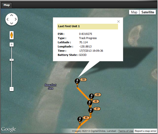
The Arctic Joule's position on the morning of July 17th local time

The Arctic Joule's position on the morning of July 17th local time

Having established where they were, I enquired about where they were going and how quickly, particularly since there seemed to be considerable quantities of sea ice in their path. Kevin told me their progress had again been hindered by strong northeasterly winds, but that they weren't currently in a desperate rush since all that sea ice would need to clear from Franklin Bay and the start of the Amundsen Gulf before they could attempt to proceed beyond Cape Bathurst. Here's how the Canadian Ice Service map of the Amundsen Gulf looks at the moment, with the approximate position of the Arctic Joule added:
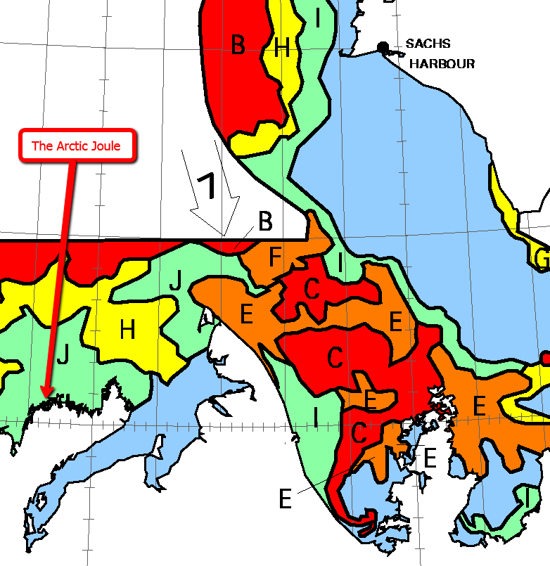
The Southern Amundsen Gulf blocked by 90% sea ice

The Southern Amundsen Gulf blocked by 90% sea ice

As you can see, the red areas labelled 'C'  for 90% concentration of sea ice over 1.2m thick are right in the rowers' path, and currently predicted to drift even further south. You will also note that the Arctic Joule is currently in an area coloured green on the map and labelled 'J' for about 20% concentration. As luck would have it the skies were clear above Cape Bathurst today, so it's also possible to take a look at a satellite's eye view of that sea ice. This image is courtesy of NASA Worldview:
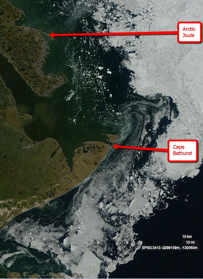
The Amundsen Gulf as seen by the Terra satellite on July 17th 2013

The Amundsen Gulf as seen by the Terra satellite on July 17th 2013

Needless to say I asked Kevin if he'd actually seen any of that sea ice. He told me that whilst they were seeing "ice in the distance more and more" there hadn't been a lot nearby, although the boat had received "an eye-opening thump" from a "partially submerged chunk the size of a dinner table".  This naturally led me to ask how the Arctic Joule had coped with this encounter. It seems the vessel survived unscathed, having being sturdily built and shaped similarly to Roald Amundsen's Gjøa, the first ship to successfully navigate the Northwest Passage, to ensure that it would ride up over encroaching sea ice rather than being crushed by it. It seems there is a downside to this method of construction though. The Arctic Joule weighs around 1200 kg, which makes it tough to manhandle through shallow water, or over land or ice. By way of example:

Pushing the rowboat into Tuktoyuktuk – July 12 2013 from Mainstream Last First on Vimeo.

Hoping it might be some sort of a consolation I pointed out that the sort of "wide angle" Arctic sea ice forecasts I look at on a regular basis suggest that the ice in their way would soon be gone:
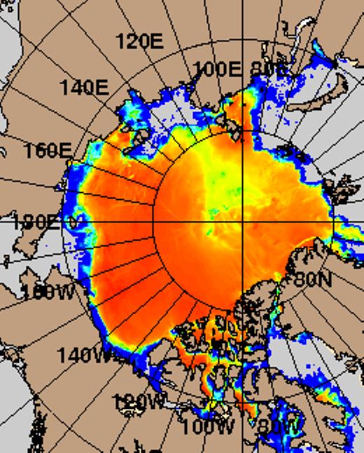
US Navy Arctic sea ice concentration forecast for July 24th 2013

US Navy Arctic sea ice concentration forecast for July 24th 2013

Assuming that the twin hurdles of wind and ice will soon be crossed, I then asked Kevin about the team's planned route through the Canadian Archipelago, and how quickly they hoped to travel along it. After stopping at Cambridge Bay, the shortest route takes the Arctic Joule north past the western side of King William Island. However if ice conditions there prove too difficult plan 'B' involves taking a longer route via Gjøa Haven. Moving on from direction to speed, I was assured that "on a good day we can cover 75 or even 100 km, but on a bad day we might struggle to do 20 km".

It struck me that a few more "bad days" like those they had already experienced might mean that the long Arctic night would be drawing in by the time they were approaching their ultimate destination. Kevin told me that it's perfectly feasible to keep rowing through the night as long as the moon is out. When it gets too dark just drop anchor!

Kevin and I also discussed a variety of other topics, including fitness, food and drink. More on all that in another article on another day, but for the moment I'll merely add "Bon voyage, Arctic Joule!".

Filed under Adventure by

July 12, 2013

The "Quest Through the Pole" Begins in Barrow

We've recently been following the progress of the Arctic Joule as her crew attempt to row through the Northwest Passage, and now comes news of another expedition across the Arctic, this time powered by the wind.

Babouchka is "a special boat capable of sailing over water and ice", and she set sail from Barrow, Alaska on July 6th. Crewed by Sébastien Roubinet and Vincent Berthet, their joint quest is:

To cross the 3,300 kilometers that lay between Barrow, Alaska, and Spitsbergen, Svalbard — and crossing the North Pole as they go.

Their sails filled with the same easterly winds that have bedevilled the Arctic Joule, here's a GPS record of Babouchka's progress so far:

Babouchka's progress by July 12th 2013

Babouchka's progress by July 12th 2013

The July 8th entry in their English language journal says:

Sebastien and Vincent left Barrow at around 4pm on July 6th, and sailed 6 nautical miles in free water from Point Barrow before reaching ice and had to decipher: lands of recent thin ice, blocks moved by tidal current, and large slabs with high pressure ridges across which they finally decided to push Baboushka during a few hours before stopping for setting up the "night" camp.

A few hours later, they moved upwind for a few nautical miles ahead on ice too thin to carry their weight. The afternoon was a little better with stabilized ice, and sails were up to help, but they waded in water most of the time. The reward was an evening camp on a large slab that drifts at 1 knot in the right direction! Let's hope they reached the Beaufort Gyre which will help them gain some distance while sleeping.

According to the team's Facebook page yesterday:

After 5 days… Sea ice is really chaos! Latitude: N 71°38.62, Longitude: W 158°14.49. Distance : 44.30 Nm = 82.05 km

Yesterday's French language journal entry, roughly translated into English by Google, says:

Hopefully, we'll sleep well because the wind has finally calmed down. Tomorrow we continue our journey W / NW to reach a more dense area of ice, which should enable us to accelerate and make a more direct route.

Perhaps the lighter winds will prove to be of assistance to the crew of the Arctic Joule too?

Finally, for the moment at least,  if you're wondering what "sailing across ice" looks and sounds like, here's a video of a previous incarnation of  Babouchka doing just that:

Filed under Climate by

July 10, 2013

South Brent Community Wind Turbine Nears Completion

Following our trip to South Brent earlier this year I purchased a few shares in the South Brent Community Energy Society Limited. Following my own modest contribution the society raised all the funds it needed to install a "remanufactured" Vestas V27 wind turbine just outside South Brent without needing to borrow from a bank!

I've received a couple of emails from the society recently. The first informed me that:

We are expecting the wind turbine to be delivered and installed from Monday 15th July.

but the one I received this morning says that:

Unfortunately the installation has been delayed. On final inspection a gear component was found to be out of specification and although this will only take a few days to put right it throws out the logistics of getting everything and everyone together.

Spectrum Energy are now working towards delivery and installation around the 3rd week in August.

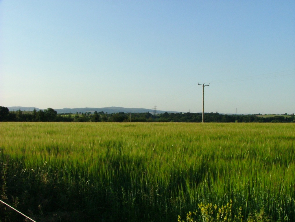
The site is all ready and waiting to receive the tower and turbine, and whilst we all wait with bated breath for August to arrive, here's a gallery of how things look over there at the moment. Note in particular the healthy looking crop of barley in the vicinity.

The view towards Dartmoor

The view towards Dartmoor

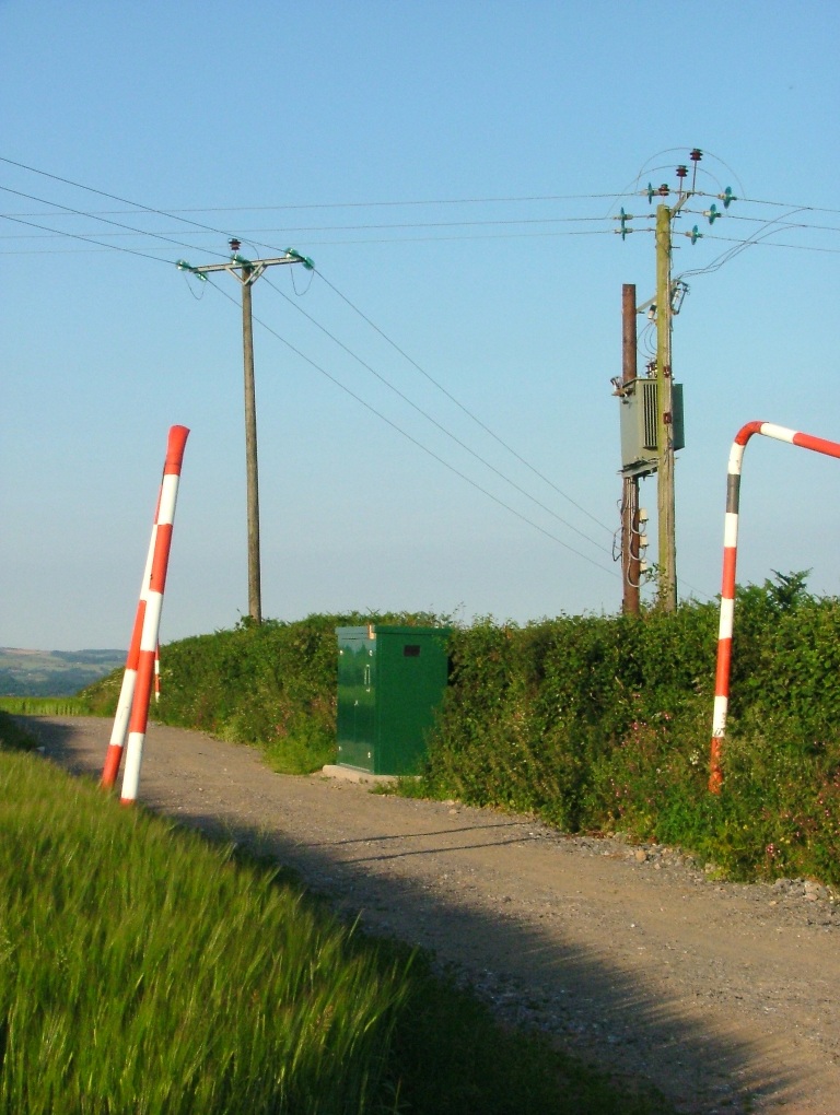
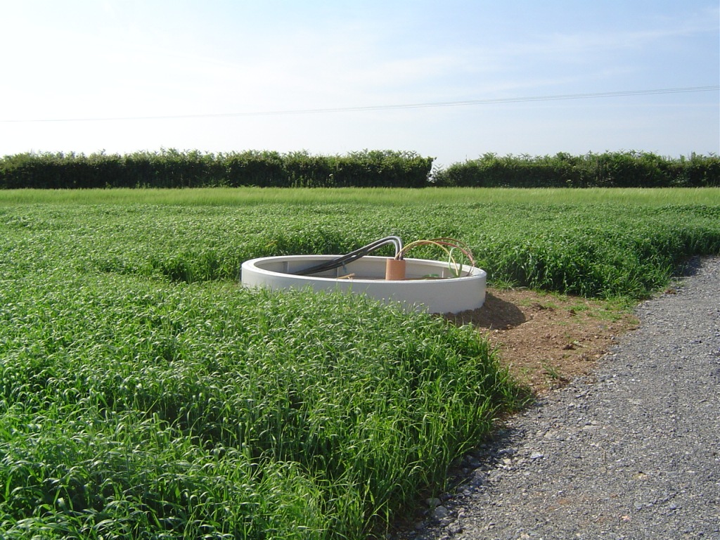
The South Brent community wind turbine grid connection

The South Brent community wind turbine grid connection

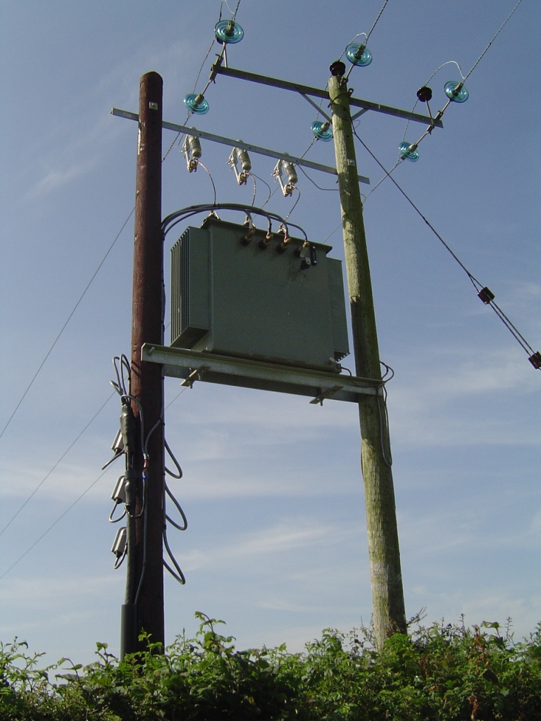
The transformer

The transformer

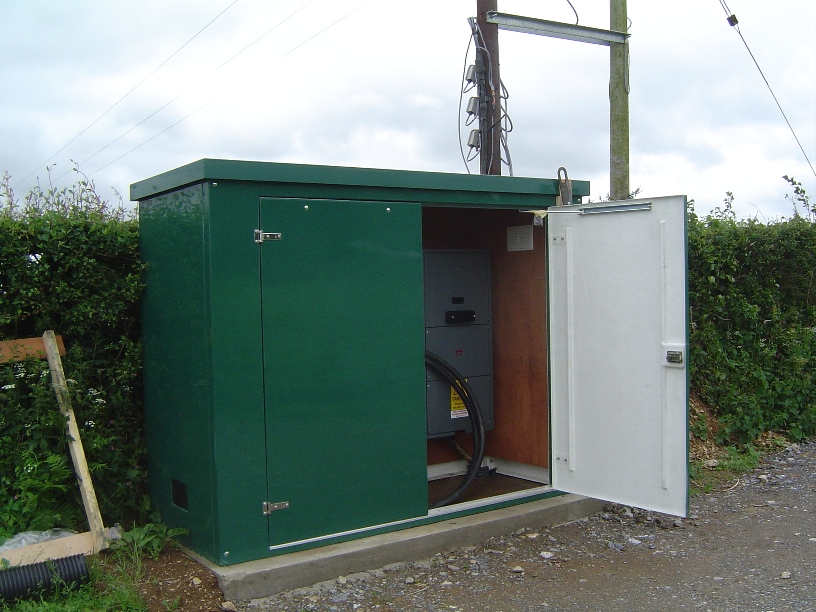
The South Brent community wind turbine grid connection kiosk

The South Brent community wind turbine grid connection kiosk

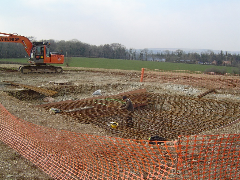
In case you're wondering what's underneath the barley, here are a few more pictures that SBCES took earlier:

A large quantity of steelwork

A large quantity of steelwork

The concreted foundation, with solar panels in the background

The concreted foundation, with solar panels in the background

All ready and waiting for the tower and turbine

All ready and waiting for the tower and turbine

Filed under Renewables by

July 6, 2013

The Arctic Joule Races Towards the Beaufort Sea

I first met Kevin Vallely in a rather unusual location for both of us. The British Ambassador's residence in Oslo! We were both holding a small glass of red wine, and started talking about Arctic sea ice. We agreed it was disappearing quickly, and Kevin assured me that he "wasn't crazy enough to try and walk to the North Pole" this year. He did however explain to me a bit more about his plan to row through the Northwest Passage, which he had earlier explained to the delegates attending the Economist Arctic Summit. He assured me that he and three companions would attempt to row through the Canadian Arctic Archipelago in "the last world first!". They were planning to start on July 1st 2013, rowing in teams of two for 24 hours a day, for about 75 days.

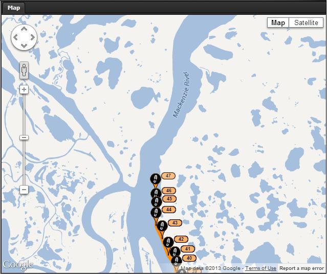
Slightly later than planned back in March, that no doubt arduous and dangerous journey has now started. You can follow the progress of Kevin and his companions on the expedition web site and/or on their Facebook page. Here's how their first day on the water has progressed so far:

The MainStream Last First Expedition's position at lunchtime on Day 1 (UK time)

The MainStream Last First Expedition's position at lunchtime on Day 1 (UK time)

Note that currently they are racing at a considerable rate of knots down one branch of the Mackenzie River delta, and have reached the big bend where it turns Northeast for the first time. At this rate it looks as though they'll be in the Beaufort Sea before their first day is over.

The main sponsor of the expedition is Mainstream Renewable Power. As you can see from this video of the team in training, their watercraft (christened the Arctic Joule)  is duly plastered in solar panels which charge up their batteries during the (very long!) Arctic day:

Aerial footage from Mainstream Last First on Vimeo.

According to their initial press release:

Four modern-day explorers from Vancouver will attempt a world first by rowing the 3,000 km Northwest Passage in a specially commissioned boat by human power alone in a single season..a feat only possible now due to the melting ice in the Arctic. Global wind and solar company Mainstream Renewable Power is sponsoring the expedition to bring awareness to the profound effects climate change is having on the environment.

Here at econnexus.org.uk we'll be following their progress with much interest over the next three months, looking at how they're getting along with the raising of awareness as well as with the rowing. We'll also be taking a good look at the state of the ice they will be navigating amongst. In the meantime here's a map showing the Arctic Joule's position in real time:

Filed under Climate by