July 21, 2013
A Storm is Brewing in the Arctic
Here at econnexus.org.uk we're used to tracking hurricanes, but so far there's been a fairly quiet start to the 2013 Atlantic hurricane season. The strongest tropical storm so far has been Andrea, whose winds reached a maximum speed of 65 mph (100 km/h) around a minimum central pressure of 992 mbar. The National Hurricane Centre currently reports "No tropical cyclones at this time" for both the Eastern Pacific and the North Atlantic. Despite that an "extra-tropical" cyclone looks like it's on its way next week, far to the north of both those oceans.
Last Friday I was perusing some weather maps of the Arctic, trying to work out when there might be any change in the persistent northeasterly winds that have been hindering the progress of The Arctic Joule as its crew of four attempt to row through the Northwest Passage from west to east. I found myself looking at this surface level pressure chart on German weather site WetterZentrale:
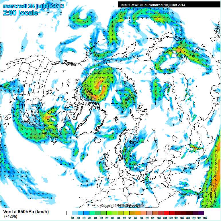
If you click on the image then look closely at the centre of the green area you can just make out in amongst the tightly packed isobars of a large cyclone a predicted central pressure of less than 980 mbar, which is a lot lower than Andrea managed to achieve earlier this year. That certainly looks like it will put some strong winds behind the Arctic Joule next week, and promises even stronger winds for the crew of the other Arctic expedition we are following at the moment – Séb Roubinet and Vincent Berthet who are attempting to sail their catamaran Babouchka over both sea and ice right across the Arctic Ocean. To find a wind forecast I switched to French weather site MeteoCiel which seemed entirely appropriate in the circumstances. There I found this forecast:
That shows a maximum wind speed of over 90 km/h, although thankfully that's over the northern Beaufort Sea rather than Babouchka's current location in the southern Chukchi Sea.
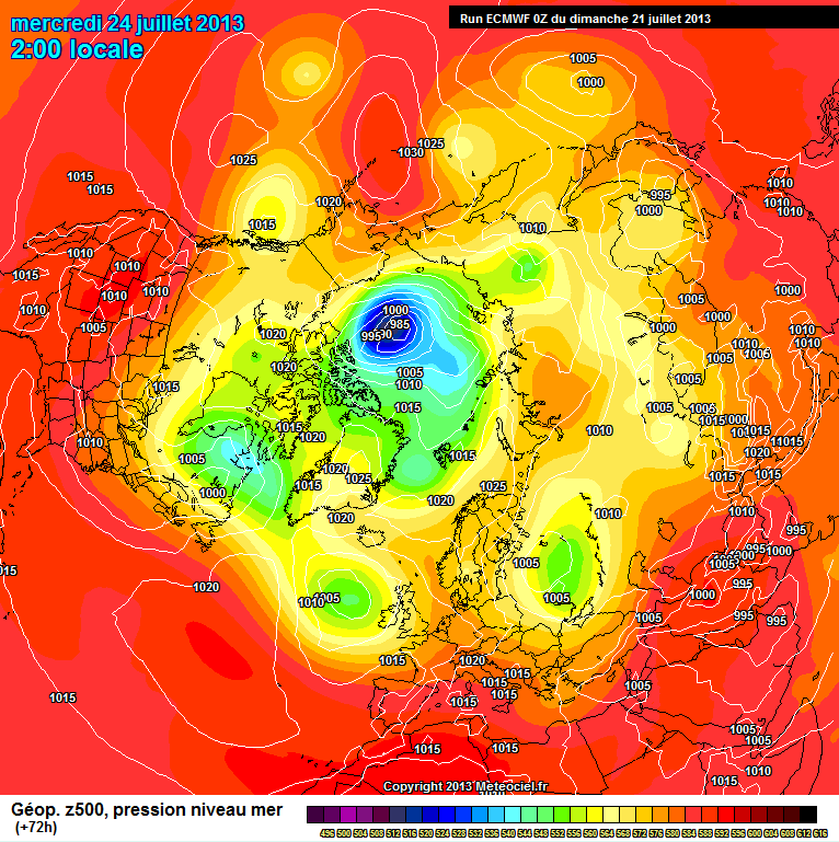
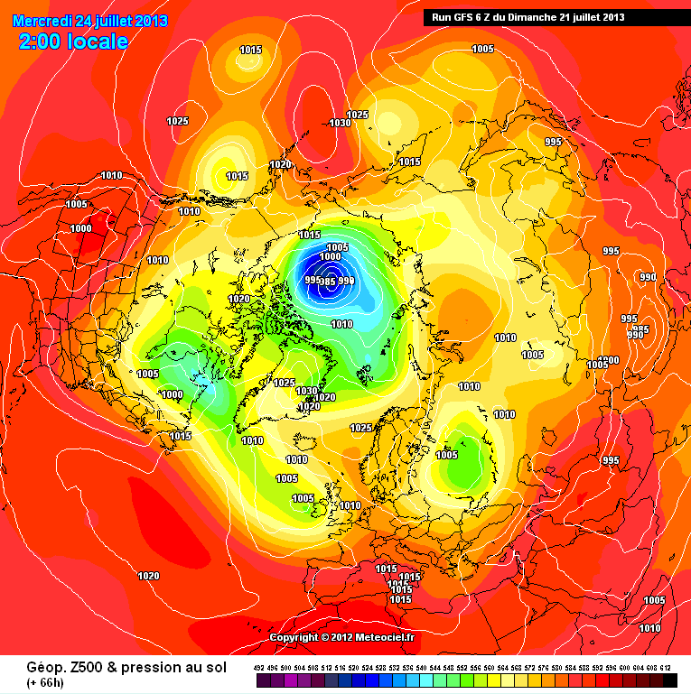
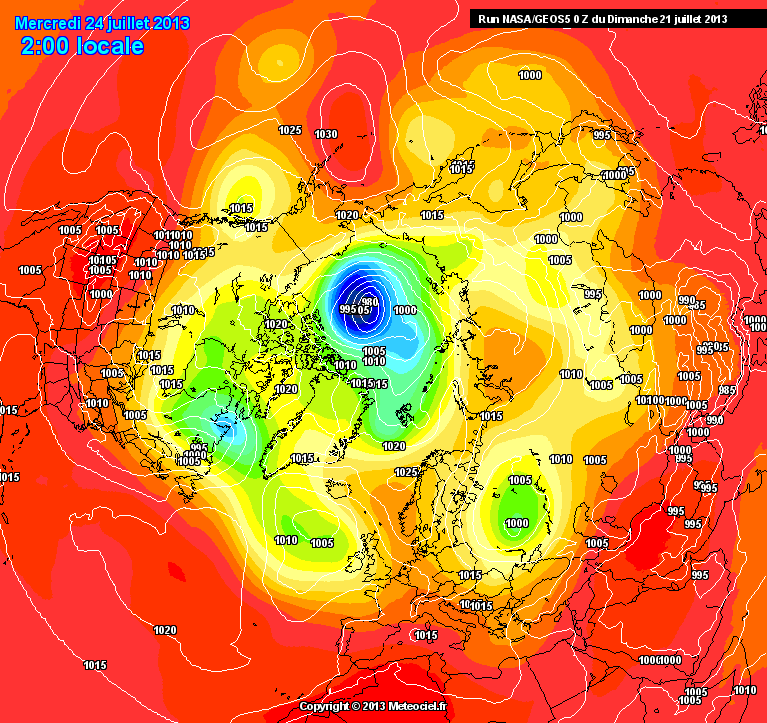
Regular readers will recall that during Hurricane Sandy last year the American GFS forecast model was predicting a very different track for Sandy than the European ECMWF model, so today I've been comparing forecasts for the Arctic once again. This time it seems the various models are all in agreement that this Arctic cyclone will happen, although the fine details are slightly different. Here are three of today's forecasts for next Wednesday, once again courtesy of MeteoCiel:
One big question now is exactly how strong will the winds be that will soon be buffeting both teams of intrepid explorers currently afloat in different places in the path of the cyclone?
Another big question is exactly how the forthcoming storm will affect the increasingly fragile sea ice in and around the Beaufort Sea. Here's a "before" picture, courtesy of The Cryosphere Today:
During and after will follow over the next few days. Whilst we wait to see what actually transpires, here's the US Navy's forecast for ice speed and drift for July 27th:
Filed under Climate by


Comments on A Storm is Brewing in the Arctic »
The arctic storm has been in the models now, in one form or another, for about 8 days now. Earlier it was forecast to trek a bit further south, with the cold front extending down to the Brooks Range. More recent model trends are north with this system so this should keep the core of the storm over the northern Beaufort and the Canadian Archipelago. However, the core of this storm is going to be very cold. ECMWF precip amounts forecast a 3-6" snow event over the Beaufort Sea (sea-ice area) with this storm and a large core of below freezing temperatures. Additionally, the wind direction will be from the west-northwest following the storm, helping to keep ice within the Beaufort Gyre, where it has a general tendency to blow/drift out of that basin this time of year. Furthermore, since the storm will curl east-northeast toward the northern Canadian Archipelago, as opposed to dropping down toward Hudson Bay, the circulation pattern over the high Arctic will be conducive for harboring the ice present, perhaps even expand the ice pack, albeit at a lower concentration.
Nice update, Jim, and great that you follow those expeditions so closely. I'll refer to it if I manage to write a blog post on these efforts in the coming week.
Hi, I was wondering why the navy model shows the onset of storm-related drift about two or three days after the storm has passed. Is it delay of ice and ocean response to winds or something else? Thx! Great post
TomC says this will increase the ice. What do you think? Or is it too early to say.
Superb work, thanks.
@Susan Anderson
To clarify, the ice area metric will likely decrease by a little over 400,000sq.km. over the next week (from the current 5.28Msq.km. to about 4.85Msq.km – UIUC) but ice extent will likely decrease very little overall, maybe by an average over 30,000sq.km/day mainly due to loss on the Atlantic side. Ice extent will tend to increase on the Pacific side in the Chukchi and Beaufort Seas (after a slight decrease in the south flow ahead of the storm) as the wind flow will be strong from the west-northwest for 60-72 hours following the storm. This direction of wind flow and strength will more than counterbalance the compaction before the low's passage.
In prior years a strong high pressure present over the Beaufort in the spring really helped to blow much of the ice in that basin toward the west, away from Banks Island and allowing for insolation to warm those waters (as well as collapse the landfast ice within the Northwest Passage earlier to open those waters as well). This year that hasn't been the case and ice has been allowed to remain within the waters of the Beaufort. There's only a narrow 10-20 mile strip of open water along the north coast of Alaska this year whereas the last several years the ice edge has already retreated a couple hundred miles into the Arctic Basin. So when the wind comes in from the west-northwest following this storm the ice won't be blowing into large areas of open water already warmed through insolation to melt. It'll be blowing into a narrow strip of colder waters where it will fend off the melting to some degree.
Another thing to take note of is after this storm passes near the end of the month the sun angle in the arctic will begin to drop at a much faster rate, with the first sunsets of the year between 70-73°N (the area in question) happening during the last couple days of July/first few days of August. It's going to be hard to have a rapid melt off of ice in such prevalence after the first week of August.
What little expertise I possess in "weather forecasting" derives from trying to predict the surf on the north coast of South West England in the good old days before there were lots of webcams to do that job for you. The Arctic continually surprises me!
To answer David's question, here's an explanation of the inner workings of the US Navy's ACNFS and its assorted atmosphere/ocean/ice models. For the atmosphere they utilise yet another model called NOGAPS, which may have come to its own conclusions about what will happen over the next few days. Motion of the atmosphere certainly takes some time to build a big swell in the ocean, so I assume the same holds true for ice, but I could easily be wrong!
[Edit – It seems my information was a trifle out of date. NOGAPS was replaced by NAVGEM earlier this year. Here's the NAVGEM surface pressure forecast for Wednesday, for comparison purposes]
Going back to ECMWF, here's the current temperature forecast for Wednesday:
You can certainly see the cold core Tom refers to. As for the amount of open water in the area, here's today's picture from a webcam mounted on O-Buoy 8 which is in the middle of the Beaufort Sea:
All in all there are a wide variety of things that might happen to the ice over the next few days, as illustrated by this graphic from the University of Washington showing "Atmosphere-Ice Coupling" in the Beaufort Marginal Ice Zone:
At this juncture I reckon it's impossible to predict how things will eventually turn out, but I will continue to examine all the evidence, and report back here!
Thanks for the responses! Matter for study there, for this amateur amateur. I do love good graphics, they make it much easier to take in information.