July 23, 2013
The Approaching Storm in the Beaufort Sea
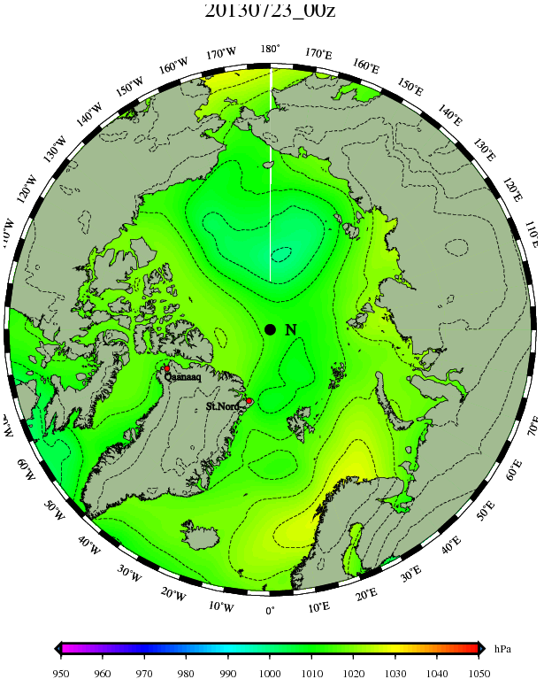
We've been following the approaching cyclone in the Arctic for a few days, and this morning the predictions are starting to come true. Out of all the various forecasting models we've looked at so far only ECMWF offers a "nowcast". That's the model's idea of what's happening in real time in the real world, and here's how it looked over the Arctic first thing this morning, as visualised by the Danish Meteorological Institute:
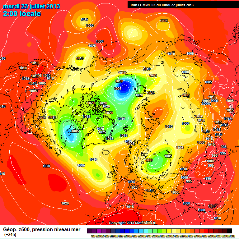
Apart from being zoomed in on the Arctic the isobars don't look too different to yesterday's ECMWF forecast for this morning, available from the MeteoCiel archives:
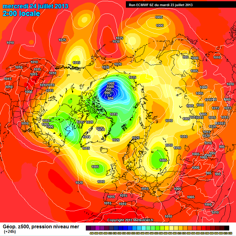
That should give us some confidence that the ECMWF model's prediction for midnight tonight GMT will come to pass:
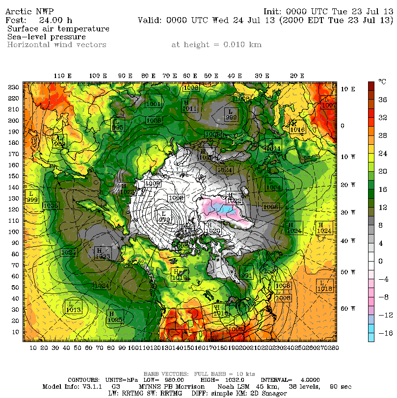
What is likely to be of most concern to the members of the two teams currently in small boats in the Arctic is, however, the wind speeds near the surface rather than the atmospheric pressure, and the effect those winds have on the ice. That information is a bit harder to come by. Obviously if you want to model what's going to happen to sea ice in the Arctic you need to model what's going to happen to the atmosphere just above the ice. The US Navy's NAVGEM model does just that, but the output is a bit hard to read when the isobars get packed closely together as they're predicted to do over the next 24 hours or so. However as luck would have it the ECMWF recently received a presentation on yet another forecasting model, called Polar WRF. This model has been specially designed to work better in the polar regions than more general purpose atmospheric models, and here is its forecast for midnight tonight:
It's still rather hard to read, but hopefully if you click on the image above you will just about be able to make out all the little arrows with 2 or 3 "barbs" clustering around the cyclone which has a predicted central pressure of 979 millibars.
After all these assorted predictions you may well be wondering exactly what's happening at sea (or ice) level in the Beaufort Sea. As more luck would have it the webcam we showed you a couple of days ago is mounted on the same floating buoy as a weather station, which reports that the pressure is indeed dropping whilst the wind is rising:
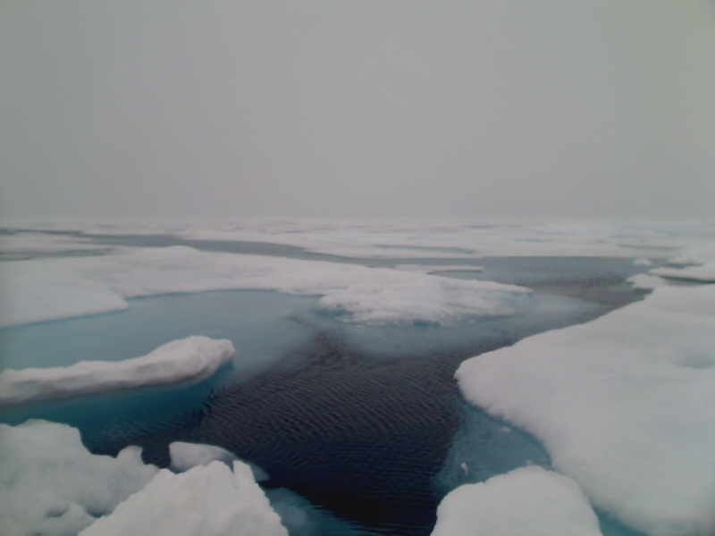
The waters of the Beaufort Sea are starting to look slightly agitated:
Filed under Climate by

Comments on The Approaching Storm in the Beaufort Sea »
Here's a picture of the cyclone taken yesterday from the Aqua satellite, courtesy of NASA Worldview:
Thus far the storm seems have to have to have fallen short of the "worst" predictions. Here's the ECMWF "nowcast" for midnight last night:
The forecast for midnight tonight shows the central pressure reducing further, to below 985. Going to the opposite extreme, here's what the ECMWF model is currently forecasting for 10 days time:
The other models don't forecast that far ahead, but it will be interesting to see if the current storm does in fact eventually develop a "second wind".
In the meantime Tom's forecast for some snow looks to have been correct. Here's an image from another webcam in the Beaufort Sea:
This one's from O-Buoy 7. The sensors on another buoy nearby suggest that what it calls the "ice surface" rose by about a centimetre over the last day or so.
Here is a link to Environment Canada weather site that has a map of active weather stations along the route. You can toggle between current conditions and an hourly summary for the previous 24 hours, including wind speed and direction. It also
has a link to current ice conditions.
http://weather.gc.ca/marine/weatherConditions-24hrObsHistory_e.html?mapID=05&siteID=00607&stationID=WLI
Thanks for the handy link Reggie.
Unfortunately Environment Canada seem unaware that O-Buoy 8 and its associated weather station, currrently located at 74.10 N, 138.53 W, really should be on their map too!
Here's the ECMWF "nowcast" for noon, confirming a central pressure below 980 mbar:
Followed by the Polar WRF nowcast, which puts that number at 977 mbar: