August 31, 2015

Hurricane Fred Threatens Cape Verde Islands

Way back on May 9th we reported on an unusually early start to the 2015 Atlantic Hurricane Season. Things have been fairly quiet since then. There have been a few named tropical storms, one of which became Hurricane Danny on August 20th. Danny didn't pose much threat to life and limb, but another unusual tropical storm is about to change that. At 06:00 UTC this morning the National Hurricane Centre advised that:

FRED BECOMES A HURRICANE AS IT MOVES CLOSER TO THE EASTERNMOST CAPE VERDE ISLANDS.

LOCATION…15.3N 22.5W

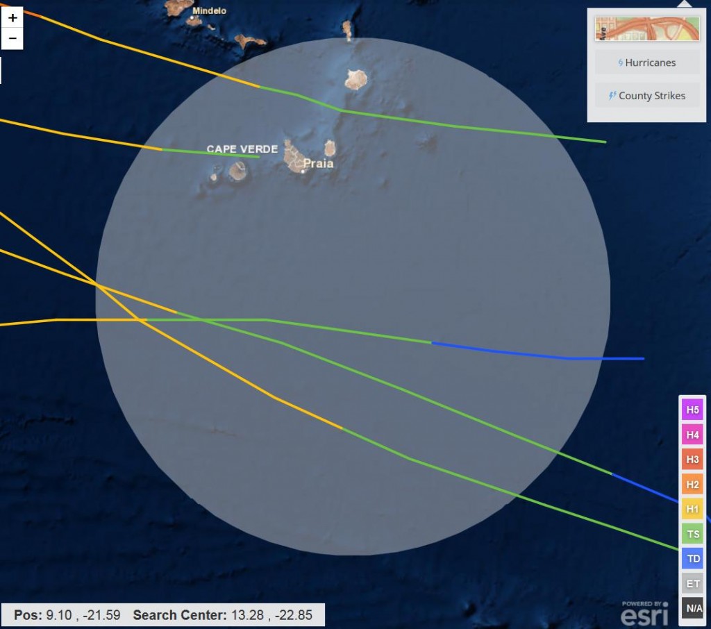
Fred is unusual because he's still so close to the African coast. It's very rare for an Atlantic hurricane to form at a longitude east of 35 degrees west. The only one that formed in the area that I can find in NOAA's historical records is an unnamed hurricane from September 1892 that reached hurricane force over the islands:

The 09:00 UTC bulletin from the NHC reports that:

HURRICANE FRED CONTINUES TO STRENGTHEN AS IT MOVES THROUGH THE EASTERNMOST CAPE VERDE ISLANDS…

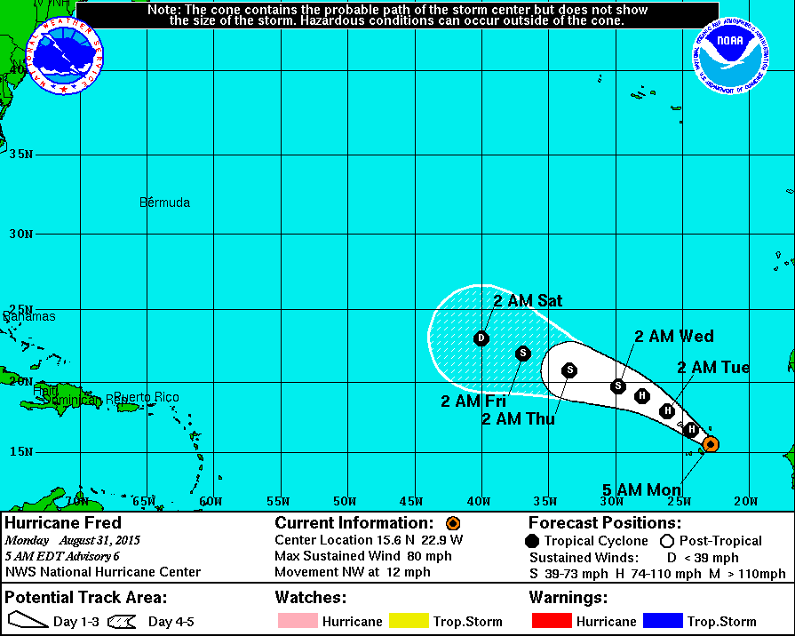
LOCATION…15.6N 22.9W
ABOUT 35 MI…55 KM S OF RABIL IN THE CAPE VERDE ISLANDS
ABOUT 65 MI…100 KM NE OF PRAIA IN THE CAPE VERDE ISLANDS
MAXIMUM SUSTAINED WINDS…80 MPH…130 KM/H
PRESENT MOVEMENT…NW OR 305 DEGREES AT 12 MPH…19 KM/H
MINIMUM CENTRAL PRESSURE…989 MB…29.21 INCHES

A Hurricane Warning is in effect for the Cape Verde Islands

A Hurricane Warning means that hurricane conditions are expected
somewhere within the warning area, in this case within the next 6
to 12 hours. Preparations to protect life and property should be
rushed to completion.

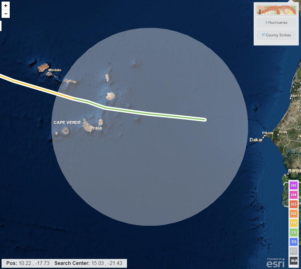
Here's Fred's current forecast track:

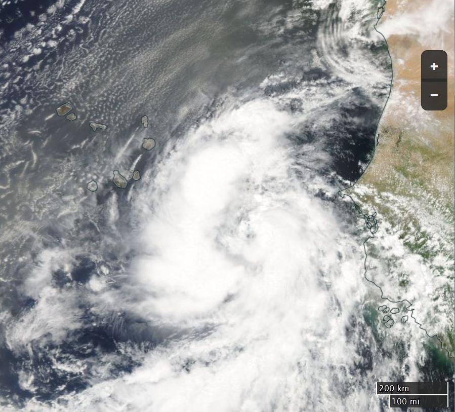
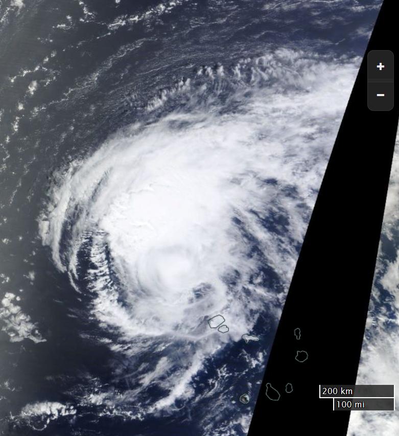
and here's how Fred looked from space yesterday:

[Edit – 14:45 UTC 31/08/2015]

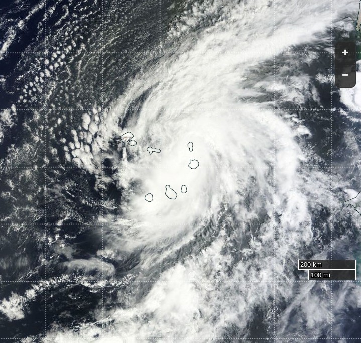
The view of Fred from the Terra satellite today:

Here's a video of the effect Fred is having on Sal Island, which is the most northeasterly in the image above:

[Edit 01/09/2015]

Thanks to mosomoso for pointing out that in 1900 a hurricane formed east of the one in 1892, but still west of Fred:

The view of Fred from the International Space Station yesterday, courtesy of Scott Kelly:

The view of Fred from the Terra satellite today:

Filed under Climate by
Comments on Hurricane Fred Threatens Cape Verde Islands »

August 31, 2015

Jim Jim @ 12:23 pm

The 12:00 UTC bulletin from the NHC reports that:

At 800 AM AST (1200 UTC), the center of Hurricane Fred was located near latitude 16.1 North, longitude 23.5 West.

On the forecast track, the center of Fred is expected to pass near or over the northwestern Cape Verde Islands later today.

Maximum sustained winds are near 80 mph (130 km/h) with higher gusts. Little change in strength is expected through early tonight while Fred moves through the Cape Verde Islands. Gradually weakening is forecast to begin on Tuesday.

Hurricane-force winds extend outward up to 15 miles (30 km) from the center and tropical-storm-force winds extend outward up to 80 miles (130 km).

The estimated minimum central pressure is 989 mb (29.21 inches).

HAZARDS AFFECTING LAND
———————-
WIND: Tropical storm conditions are expected to continue spreading across the Cape Verde Islands today. Hurricane conditions are occurring over portions of the easternmost Cape Verde Islands and are expected to spread northwestward over portions of the northern and northwestern Cape Verde Islands later today.

Wind speeds atop and on the windward sides of hills and mountains are often up to 30 percent stronger than indicated in this advisory, and in some elevated locations can be even greater.

STORM SURGE: A storm surge is expected to produce coastal flooding in areas of onshore winds in the Cape Verde Islands. Near the coast, the surge will be accompanied by large and dangerous waves.

RAINFALL: Fred is expected to produce total rain accumulations of 4 to 6 inches over the Cape Verde Islands, with possible isolated maximum amounts of 10 inches. These rains could produce life-threatening flash flooding and mudslides.

Jim Jim @ 5:55 pm

In their 18:00 UTC bulletin the NHC say that:

FRED BRINGING VERY HEAVY RAIN TO THE CAPE VERDE ISLANDS.
CENTER PASSING VERY NEAR SAO NICOLAU ISLAND

The center of Hurricane Fred was located near latitude 16.9 North, longitude 24.2 West. Fred is moving toward the northwest near 12 mph (19 km/h) and this motion is expected to continue through tonight. A turn toward the west-northwest is expected on Tuesday. On the forecast track, the center of Fred is expected to pass near or over the northwestern Cape Verde Islands through early tonight.

Maximum sustained winds are near 85 mph (140 km/h) with higher gusts. Little change in strength is expected through early tonight while Fred passes near the northwestern Cape Verde Islands. Gradual weakening is forecast to begin on Tuesday.

Hurricane force winds extend outward up to 15 miles (30 km) from the center and tropical storm force winds extend outward up to 80 miles(130 km).

The estimated minimum central pressure is 986 mb (29.12 inches).

September 1, 2015

Jim Jim @ 1:59 pm

Fred has reduced in strength by this morning (UTC) and is now a mere tropical storm. According to the 09:00 UTC bulletin from the NHC:

At 500 AM AST (0900 UTC), the center of Tropical Storm Fred was located near latitude 18.0 North, longitude 26.1 West. Fred is moving toward the west-northwest near 12 mph (19 km/h). A motion toward the west-northwest or northwest is expected during the next couple of days. On the forecast track, the center of Fred will continue to move away from the northwestern Cape Verde Islands today.

Maximum sustained winds are near 65 mph (100 km/h) with higher gusts. Gradual weakening is forecast during the next 48 hours.

Tropical-storm-force winds extend outward up to 80 miles (130 km) from the center.

The estimated minimum central pressure is 997 mb (29.44 inches).

Here's Fred's current forecast track:


It doesn't look as though he'll be producing any big waves for either the US east coast or the UK west coast!

Leave a Comment

Fields marked by an asterisk (*) are required.

Subscribe without commenting