January 12, 2016
Pali in Early Start to 2016 Pacific Cyclone Season
In an extremely early start to the 2016 Pacific Cyclone Season the Central Pacific Hurricane Center announced early this morning that Hurricane Pali had reached category 1 strength. They currently report that:
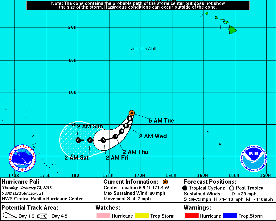
AT 500 AM HST…1500 UTC…THE CENTER OF HURRICANE PALI WAS LOCATED NEAR LATITUDE 6.8 NORTH…LONGITUDE 171.4 WEST. PALI IS MOVING TOWARD THE SOUTH NEAR 7 MPH. THIS MOTION IS EXPECTED TO CONTINUE TODAY…FOLLOWED BY A GRADUAL TURN TOWARD THE SOUTHWEST THROUGH THURSDAY MORNING.
MAXIMUM SUSTAINED WINDS ARE NEAR 90 MPH…150 KM/H…WITH HIGHER GUSTS. SLOW WEAKENING IS EXPECTED THROUGH THURSDAY MORNING.
HURRICANE FORCE WINDS EXTEND OUTWARD UP TO 25 MILES…35 KM…FROM THE CENTER…AND TROPICAL STORM FORCE WINDS EXTEND OUTWARD UP TO 105 MILES…165 KM.
THE ESTIMATED MINIMUM CENTRAL PRESSURE IS 979 MB…28.91 INCHES.
Here is Pali's forecast track over the next few days:
Fortunately that means the CPHC are able to add that:
HAZARDS AFFECTING LAND
———————-
NONE.
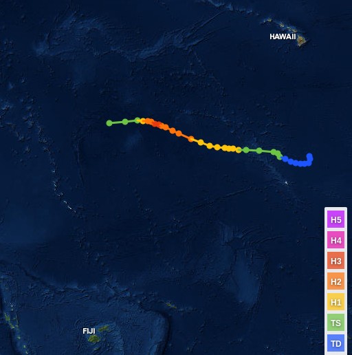
According to NOAA's database of hurricanes the previous earliest hurricane in the Central Pacific was Ekeka which achieved hurricane force on January 31st 1992:
In all the circumstances perhaps the CPHC need to update their website though? It currently states:
The Eastern Pacific Hurricane season runs from May 15 to November 30.
The Central North Pacific hurricane season officially ended on November 30th. We will resume issuing tropical weather outlooks starting on June 1st of 2016.
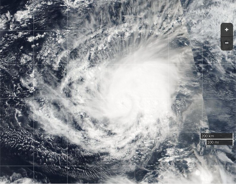
P.S. Here's a picture of Pali on the evening of January 12th, courtesy of NASA's Suomi satellite:
The latest CPHC update states:
SUMMARY OF 1100 AM HST…2100 UTC…INFORMATION
———————————————–
LOCATION…6.2N 171.3W
ABOUT 735 MI…1185 KM S OF JOHNSTON ISLAND
ABOUT 1375 MI…2210 KM SW OF HONOLULU HAWAII
MAXIMUM SUSTAINED WINDS…100 MPH…155 KM/H
PRESENT MOVEMENT…SSW OR 200 DEGREES AT 7 MPH…11 KM/H
MINIMUM CENTRAL PRESSURE…977 MB…28.85 INCHES
Filed under Climate by


Comments on Pali in Early Start to 2016 Pacific Cyclone Season »
This morning's bulletin from the CPHC about Pali reveals some slight weakening:
Meanwhile over in the North Atlantic the National Hurricane Center say:
Sticking with the North Atlantic for the moment, there's currently also a "rapidly intensifying" storm much further north than "Disturbance 1":
Overnight (UTC here in Soggy South West England) Hurricane Pali has weakened to become a mere tropical storm. The latest bulletin from the CPHC puts it this way:
but now points out that: