October 25, 2013
Extreme Weather Forecast for South West England
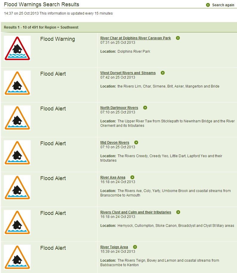
South West England is already very damp. Following a number of flood alerts earlier in the month, the Environment Agency issued several amber flood alerts in Devon yesterday, followed by a red flood warning this morning for the River Char near the Dorset Coast:
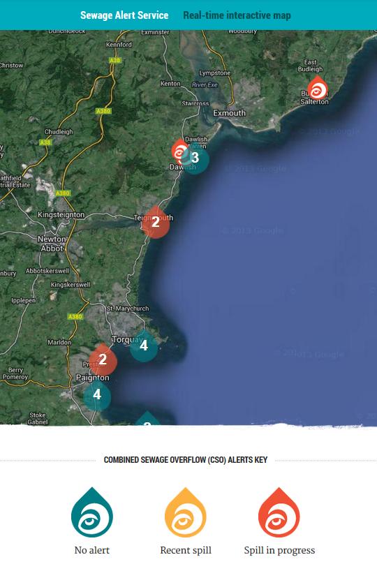
As a consequence of all the recent rain the Surfers Against Sewage interactive map for South Devon currently looks like this:
and there are also short term pollution incidents at Westward Ho in North Devon as well as at Mawgan Porth and Par in Cornwall. Meanwhile according to The Express and Echo inland at Exeter:
The River Exe burst its banks today as Exeter braces itself for more rain.
The Met Office explained the reason for the current precipitation in a blog post on Monday entitled "UK’s unsettled weather and the jet stream":
The UK is set to see unsettled weather throughout this week as heavy rain and windy conditions are expected to affect many areas, whilst temperatures will remain mild for the time of year. We talk about the jet stream quite a bit in the UK because it has such a big influence on our weather, and this week is no exception as it’s playing a leading role in determining the unsettled outlook.
As if all that wasn't enough to be going on with the Met Office has issued a severe weather warning for South West England for Sunday and Monday:
together with this video explaining the jet stream's role in their forecast:
According to the Express and Echo once again:
Hurricane-force winds and torrential rain are predicted to produce the ‘perfect’ storm that could rip down trees, cause transport chaos, and cut power supplies across the city.
The storm, which is due to hit Exeter and the surrounding area in the early hours of Monday, is expected to bring winds of 80 miles per hour and heavy rain that could lead to flooding.
The weather front, which has been named the St Jude Storm, could produce the worst conditions since the Great Storm of 1987, according to some weather analysts.
However as the Met Office video explains:
The reason why this storm is potentially going to be such a powerful feature, as it comes across the Atlantic and potentially affects the UK, is that it remains in phase with the jet stream as it crosses the Atlantic. This storm hasn't formed yet, but modern forecasting and modern numerical weather prediction models do give us a big advantage over years gone by. Although at the moment there is quite a lot of uncertainty regarding the track and the timing of this storm we are reasonably confident that a spell of pretty wet and windy weather is going to affect the UK during the start of next week.
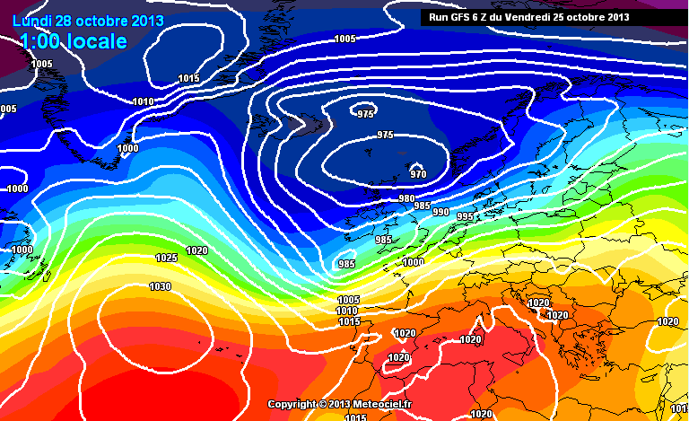
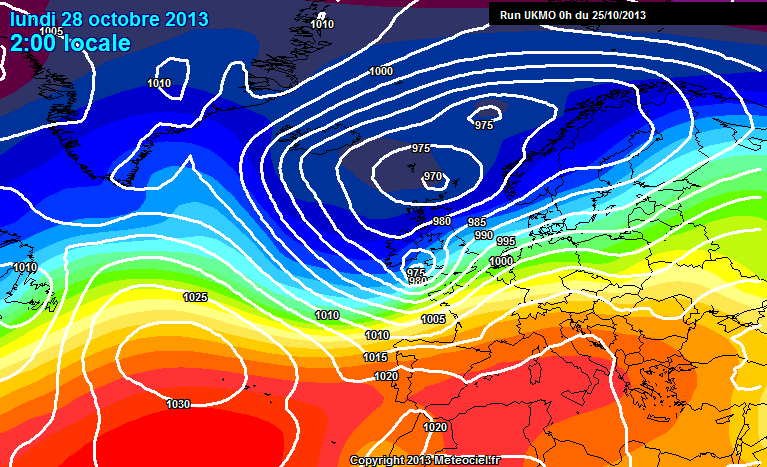
Not exactly a "perfect storm" just yet then it would seem! To give you some idea about the "uncertainty" that the Met Office refers to here a couple of other forecasts from other numerical weather prediction models for early on Monday morning. The first one is from the American "Global Forecast System", courtesy of MeteoCiel.fr:
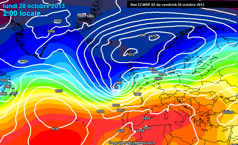
while the second is from the "European Centre for Medium-Range Weather Forecasts":
Finally here is the Met Office supercomputer's very own forecast for early Monday morning:
As you can see, there is indeed a difference of opinion between the numerical models on the predicted track and timing of the storm. At least they all currently seem to be agreed that this storm won't be as severe as the Great Storm of 1987, during which the lowest recorded pressure was 953 mbar.
Filed under Climate by

Comments on Extreme Weather Forecast for South West England »
It's now Saturday October 26th. The Met Office is still forecasting that:
The output of their numerical model for Monday looks somewhat different this morning and not quite so bad, as far as South West England is concerned at least:
Good luck and good hunting, Jim.
Thanks Susan. As it turned out the winds weren't too bad here. More problems for people in northern France and further east in England though. Germany and Scandanavia are next in line.