January 31, 2016
When Henry Met Gertie (and Jonas, and Imogen?)
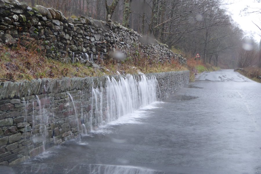
I was in a series of meetings halfway up a London skyscraper listening to the remnants of Blizzard/Winter Storm Jonas last week, so my news of Storm Gertrude is slightly belated. Before Gertie arrived one of our number had to jump on a train back to the North of England to deal with a personal flooding problem thanks to the amount of precipitation that ex Jonas deposited on the already sodden soil up there. He wasn't the only one affected:
Hot on the heels of Jonas, Storm Gertrude arrived from across the North Atlantic, with the United Kingdom's Met Office helpfully providing some moving pictures to explain that:
Very cold air is spilling southwards out of Arctic Canada and meeting much milder air across parts of the Western Atlantic forming a very strong temperature gradient, and that forces a very strong jet stream which spins these systems up.
The BBC reported on Friday that:
100mph Gales batters UK
Storm Gertrude is sweeping across parts of the UK with winds of more than 100mph causing damage to buildings, travel disruption and power cuts.
In Edinburgh, a man was hospitalised after being struck by flying debris, and a rare Met Office "danger to life" wind warning is in place for Shetland.
At least 4,000 homes are without power in Scotland and Northern Ireland. Trains, flights and ferries have been cancelled and roads and bridges shut.
There are flood warnings across the UK.
Gertrude then continued on towards Scandinavia, where she morphed into "Storm Tor". As "Norway Today" reported yesterday:
The hurricane tore loose ships and roofs
A huge supply vessel under construction was torn loose in the hurricane that ravaged in Sunnmøre Friday night. In Ålesund the hurricane was the cause of flying objects, which made it dangerous to go outside.
It must be one of the largest ships under construction in the country, but because there are no people on board, we will not get involved, the JRCC for southern Norway states to NTB.
The ship is well over 190 meters and has been torn loose and lies across the bay.

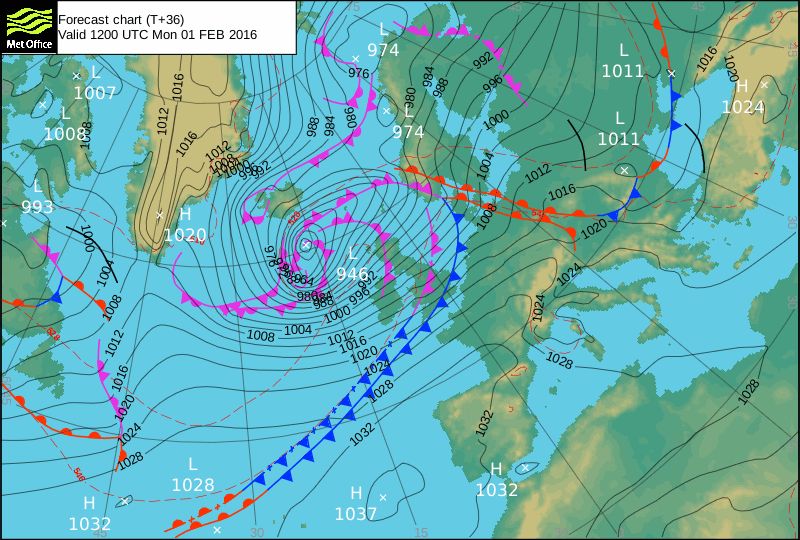
Now comes news that the Met Office have officially given the name "Henry" to the next deep low pressure system racing our way, which is due to arrive overnight. Here is their surface level pressure forecast for lunchtime tomorrow:
The German climate scientist Stefan Rahmstorf outlined his theory about the reason for the current conveyor belt of strong storms over at "Real Climate":
I will argue that this warmth (as well as the cold blob in the subpolar Atlantic) is partly due to a slowdown of the Atlantic Meridional Overturning Circulation (AMOC), sometimes referred to as the Gulf Stream System, in response to global warming. There are two points to this argument:
(1) The warm sea surface temperatures are not just some short-term anomaly but are part of a long-term observed warming trend, in which ocean temperatures off the US east coast are warming faster than global average temperatures.
(2) Climate models show a “cold blob” in the subpolar Atlantic as well as enhanced warming off the US east coast as a characteristic response pattern to a slowdown of the AMOC.
As if all that wasn't sufficiently wrathful of the gods, here is the Global Forecast System SLP forecast for a week's time, courtesy of MeteoCiel:

A week is a long time in weather forecasting, especially in the North Atlantic just at the moment, but next on the Met Office's list of names for dangerous storms is "Imogen"!
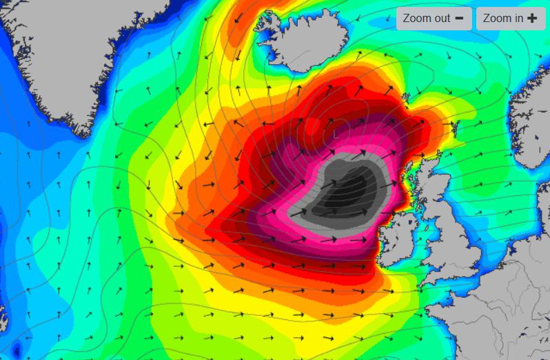
Whilst we wait to discover what swells are sweeping across the North Atlantic next weekend, here is the Magic Seaweed surf forecast for tomorrow:
Filed under Climate by


Comments on When Henry Met Gertie (and Jonas, and Imogen?) »
I went for a bike ride this afternoon, and nearly got blown off twice! Just up the hill from here Haldon Forest Park is already closed due to:
I only saw that sign when I left the forest! The winds in South-West England aren't forecast to get significantly stronger over the next couple of days, but further north it's a different story. Here's the current GFS wind forecast for tomorrow evening:
Here's the 18:00 GFS run forecast for midnight tomorrow:
which has Henry with a central pressure of 963 hPa as he passes just to the north of mainland Scotland.
Here is the UK Met Ofice's surface pressure forecast for noon today:
It shows Storm Henry with a minimum central pressure of 944 hPa.
Out in the North Atlantic off North-West Scotland Met Office buoy K5 is currently bobbing about in waves with a "significant height" of well over 30 feet, and apparently the waves are still increasing in size:
Here's a Met Office video about what to expect from Storm Henry today:
plus a satellite image of Henry located south of Iceland earlier today:
It looks as though the waves at buoy K5 peaked at almost 50 feet high earlier today:
We are experiencing unseasonably warm weather in my part of the great white north, with Toronto hitting 15.5C, setting both a daily record by 5C and record for the entire month of February.
Hi Lawrence,
Over here in Soggy South-West England we've had a rather warm wet winter (WWW for short). A few days ago I sent a bunch of early flowers to the second dumbest man on the internet, and he's just accepted them!
Meanwhile on this side of the pond the floods are back once again this morning, causing a "Danger to life" in Portreath in Cornwall according to the UK's Environment Agency: