October 7, 2012
How Global Warming Causes Bugs on British Beaches
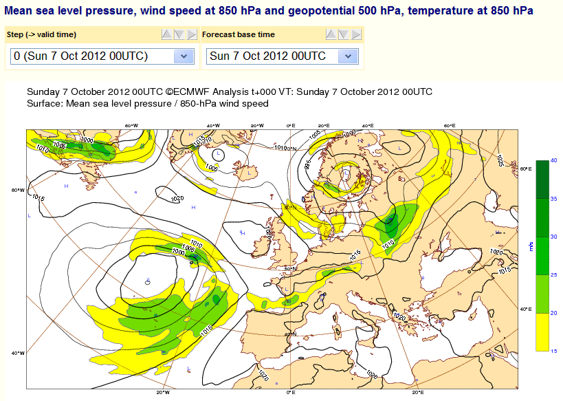
In the good old days I used to pore over atmospheric pressure charts kindly provided online by the likes of the European Centre for Medium-Range Weather Forecasts (ECMWF for short) before making a decision on exactly where and when to go surfing. Here's what they are revealing to me today:
At the moment there is a low pressure area out in the North Atlantic, which looks like it should be sending some swell in this direction. So far so good, and even better there's a high pressure area over Ireland. That means that on the north coast of South West England the waves should be onshore and the wind should be offshore at this very moment. At this juncture you may be wondering why I'm sat at my computer typing these words instead of packing my wetsuit into the car and rushing off to the coast. Please bear with me, whilst I endeavour to explain.
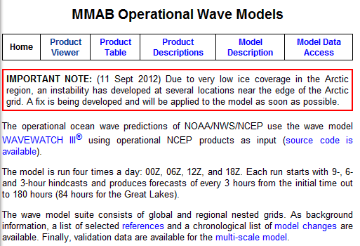
The next stage in my old routine would be to take a look at the wave forecasts kindly provided online by the United States' National Centers for Environmental Prediction (NCEP for short) and the National Oceanic and Atmospheric Administration (NOAA for short). If I head for my old stamping grounds on their web site this morning, this is what I see:
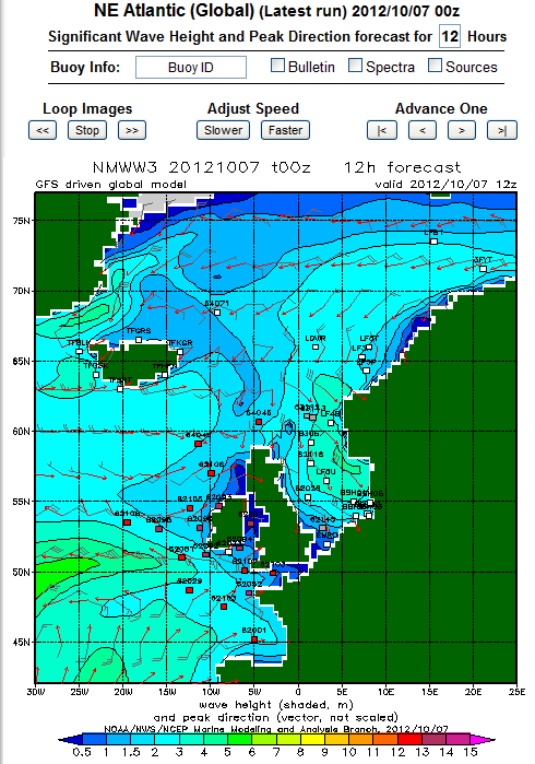
Ignoring that warning, and pressing on to their wave forecasts for the north eastern Atlantic for round about now, my suspicions are confirmed:
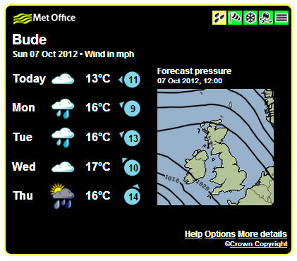
There's certainly seems to be some swell heading this way. More recently, at times like this I've taken to consulting our very own North Coast Weather Widget, kindly provided by the United Kingdom's Meteorological Office just up the road in Exeter. Here's what that is showing as we speak:
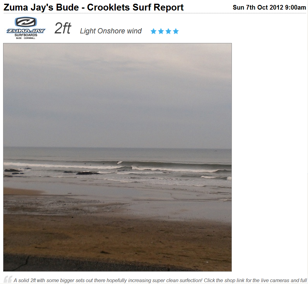
All in all there should definitely be some adequately sized and beautifully shaped waves waiting for me on the north coast. To triple check exactly what's out there I now also take a look at one of the wonderful new webcams and live surf reports that have been springing up all over the place. Here's today's report for Bude, courtesy of MagicSeaweed and Zuma Jay:
Judging from the picture the "onshore" in the title is a typo. Despite the promised "super clean surfection", in these turbulent times I've recently begun to consult even more sources of information before finally deciding to jump into my motor car. Apart from having a great desire to catch waves, we surfers also desire not to catch a few other things. Things like E. coli and intestinal enterococci for example. Unfortunately such unpleasant creatures have been in the news lately, down here in not so sunny South West England. According to the Western Morning News:
Beaches in some of the Westcountry's tourist hotspots face becoming no-go areas after water quality standards plummeted to their worst level in more than a decade.
According to the UK's Environment Agency:
Beaches at Bude Summerleaze, Budleigh Salterton, East Looe, Instow, Mounts Bay Wherry Town, Plymouth Hoe East, Plymouth Hoe West, Seaton in Cornwall and Shaldon failed to meet the basic standards this summer. Malcolm Bell, chief executive of VisitCornwall, said the bathing water quality failures caused by a "one in a 100-years" heavy summer rainfall were "regrettable."
According to South West Water:
This summer was the wettest on record for 100 years and bad weather can adversely affect bathing water quality when heavy rain impacts on urban drainage and agricultural run-off. Heavy storms can also trigger the operation of combined sewer overflows in the sewerage system.
Whilst this summer may well have been "the wettest on record for 100 years" I'm afraid I have to disagree with Malcolm Bell. This summer is no longer a "one in a 100-years event". It's rapidly becoming "the new normal". If you doubt that please take a look at the evidence presented in my recent article that provides an introduction to the new science behind this new normal. To summarise, Arctic sea-ice is currently disappearing faster then previously thought possible. "Arctic amplification" of global warming is affecting the jet stream over the North Atlantic, which in large part is responsible for bringing us our weather. In consequence the weather in South West England is also changing much faster than previously thought possible, in particular by the engineers who designed our sewage systems.
Here's a video in which Jennifer Francis, a Research Professor in the Institute of Coastal and Marine Science at Rutgers University, explains how those "Good Old Days" have now morphed into "The New Normal":
Whatever the merits of the new science of the new normal, the South West has without a shadow of a doubt just received it's second set of red flood warnings in a fortnight. Fortunately for the surfers of Bude, this one was confined to the rivers running off Exmoor and Dartmoor. Nonetheless, lets take a look at some hard facts. According to the Environment Agency's flood warning page for North Cornwall Rivers, the most recent warnings for that area were on or about August 6th and August 17-19th. If you then cross check that with the Environment Agency's weekly data on water quality at Summerleaze beach you will see that the result was a "Fail" on August 6th, with:
873 Intestinal Enterococci colonies per 100ml, 4200 E-coli colonies / 100ml
There were no test results reported for August 17-19th, but by August 25th there were still:
630 Intestinal Enterococci colonies per 100ml, 1000 E-coli colonies / 100ml
According to Andy Cummins of Surfers Against Sewage (SAS for short), reported in that Western Morning News article:
Without a doubt, this is unacceptable. We have beautiful bathing water and beautiful beaches in the West and we need our water companies to protect our assets. What is important to tourists and to local people who love the beaches is how clean the water is.
All in all I don't think I'll be tempted to go to one of the central Bude beaches today, but what about possible alternatives? A bit further up the coast into North Devon lies the wide open expanse of Woolacombe beach, and they have had a flood warning this weekend. According to the Environment Agency's flood warning page for coastal streams from Braunton to Combe Martin, the most recent warning for the area was on October 5th. According to the Environment Agency's water quality page for Woolacombe beach:
The Woolacombe Stream flows onto the beach at Woolacombe. Streams are frequently the cause of reduced water quality, particularly after rainfall. Heavy rainfall may cause operation of an overflow which can affect water quality.
Moving further down the page to check the weekly test results, please note that there was a "Fail" on July 26th, with:
6200 Intestinal Enterococci colonies per 100ml, >10,000 E-coli colonies / 100ml
With E. coli in all probability off the scale at the moment, I don't think I'll be trying to surf Woolacombe beach this afternoon either.
Filed under Climate by
Comments on How Global Warming Causes Bugs on British Beaches »
Before I stopped hopping over to the West Country in the mid oughts, I noticed there was a lot more filth and dark algae even then. So sad, such an amazingly wonderful part of the world …
Oh, and the same goes for New England's northern Atlantic, though it's less confined/more open so not quite as prevalent.
Hi Susan,
Does the New England coast have any equivalent to our "blue flag" system of beach classification, together with the associated water quality testing?
There are public notifications and regular beach closings but I'm not sure about the classification system though it does exist. This looks like a place for me to start when I have time:
http://water.epa.gov/grants_funding/beachgrants/chapter3.cfm
We did have a big water treatment facility flood in Boston not long ago, and this is a problem everywhere. ClimateCentral did a good job on Sandy (see rollovers):
http://www.climatecentral.org/news/11-billion-gallons-of-sewage-overflow-from-hurricane-sandy-15924
Some of my evidence is anecdotal and goes quite far back (mid 1970s). I used to go to Halibut Point (an old quarry in Rockport, near Gloucester, Massachusetts; search provided many images if you're interested: "Halibut Point State Park") and to paint waves and surf swirling and eddying, rockpools, starfish and seaweed and such. It was very colorful at its height (1982). Now it has become quite dark with black and green algae. The painting series finally peaked and faded, also the rich light greens, oranges, and delicate granite colors (pink, even) are mostly gone and it's quite dull. I learned a lot about time and tides from those trips.
Nice visual on topography; long elbow coming out is Cape Cod; Halibut Point is out east where it says Cape Ann.
http://woodshole.er.usgs.gov/operations/modeling/images/mass_bay.jpg
Must get back to the rest of my life, but once I started looking there is a lot. Once again anecdotally, I am sure this is an increasing problem in the Boston area and all along the shore.