March 18, 2013
The Ice Cap Crack'd From Side To Side
Unfortunately my headline this evening is not from a fictional murder mystery written by Agatha Christie. It is from a science documentary. Let me lead you through it, chapter by chapter. If you're sitting comfortably then let us begin, back on February 10th.
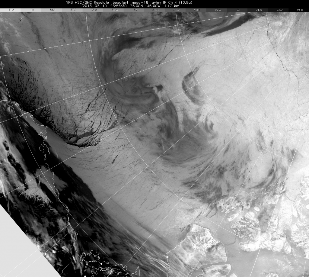
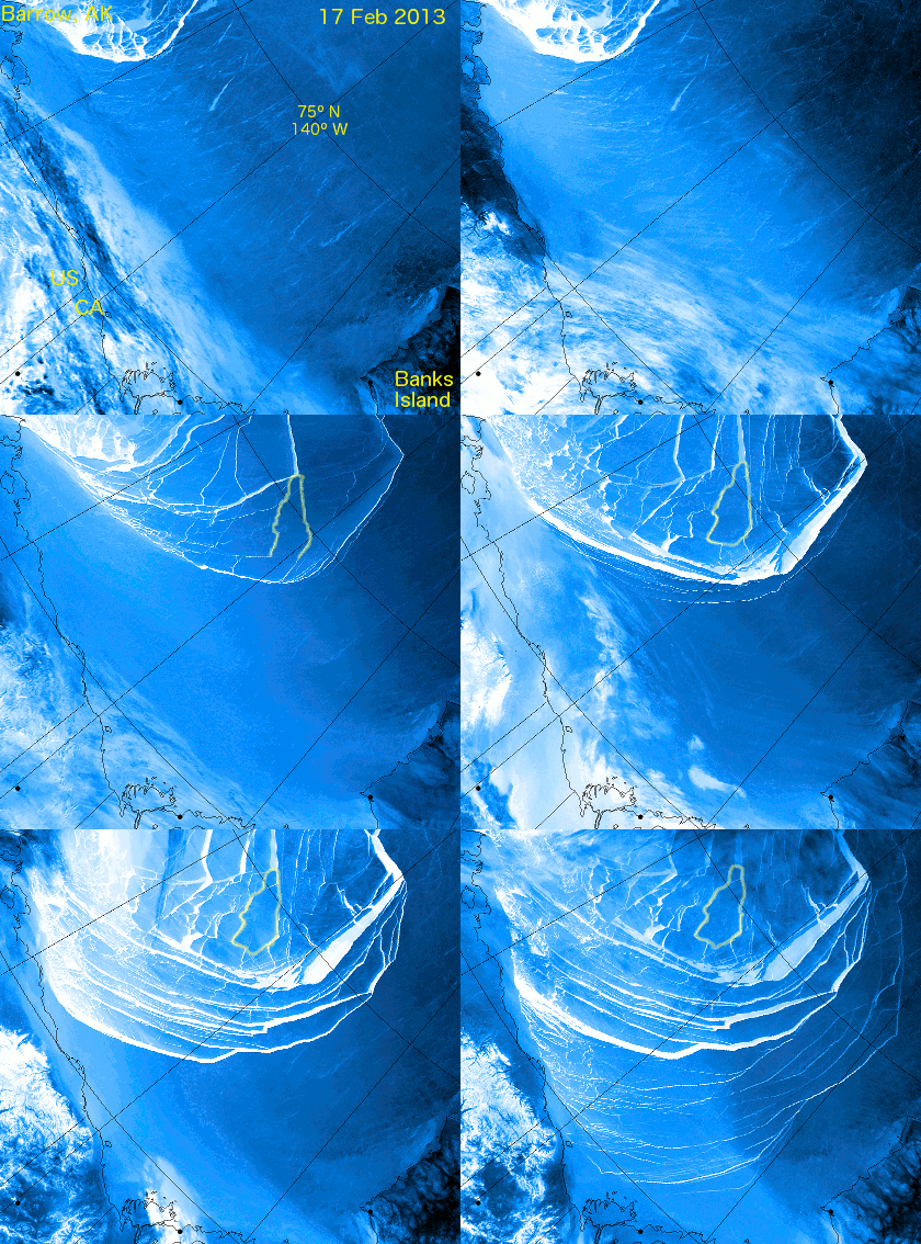
In this image (courtesy of Environment Canada) you can see significant cracks have already formed in the sea ice covering the Beaufort Sea north of Alaska, on the left of the satellite image. Now take a look at what happened next with the aid of the following animation (courtesy of "A-Team" on the Arctic Sea Ice Blog) :
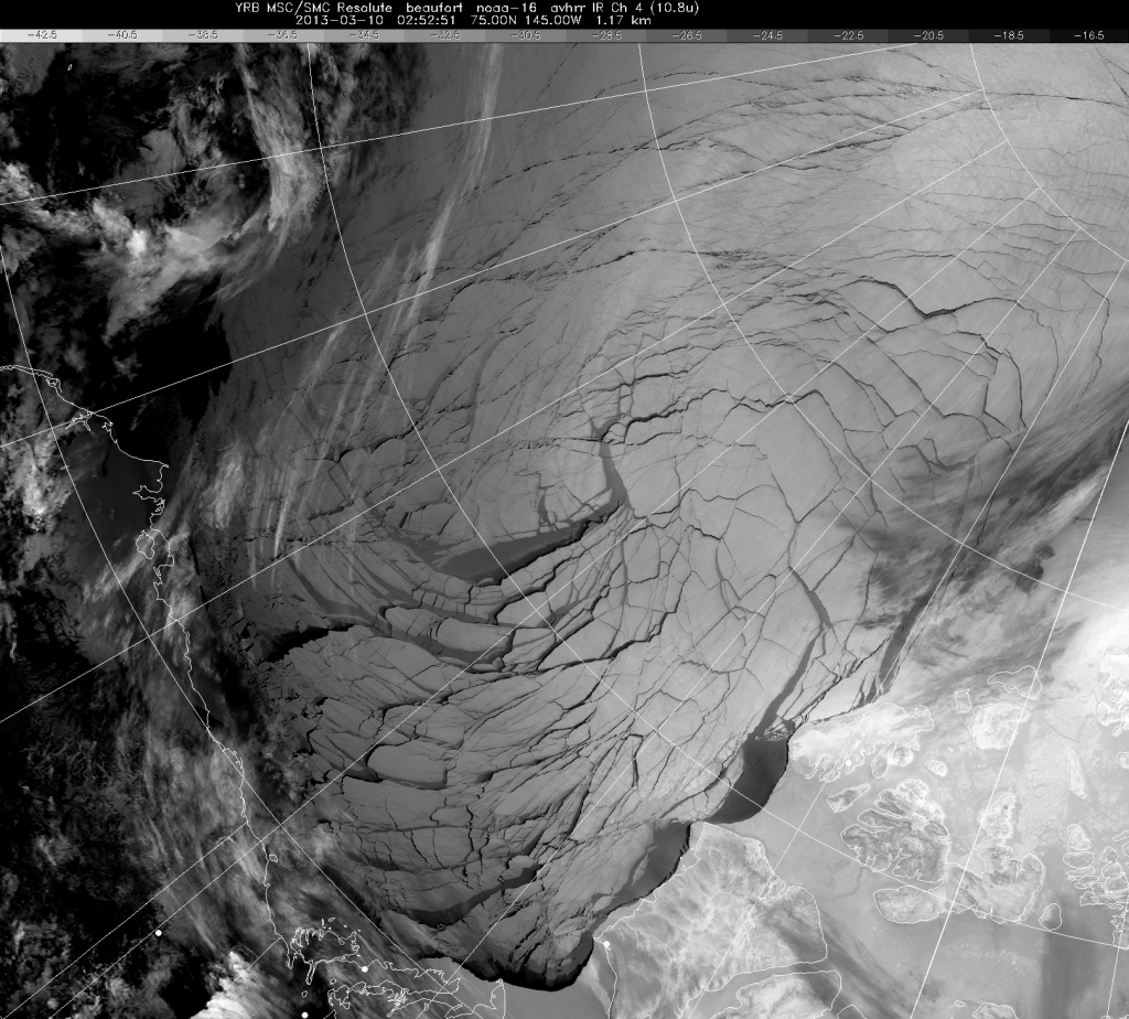
By March 10th the entire area up to the Canadian Arctic Archipelago was covered in a giant spider's web of fractures (again courtesy of Environment Canada) :
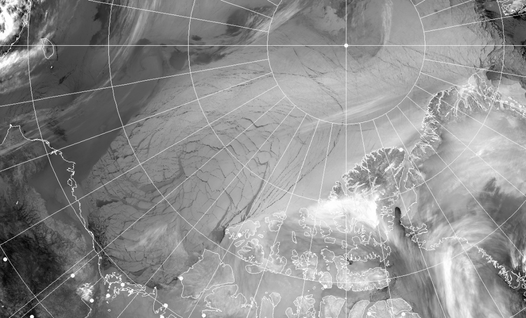
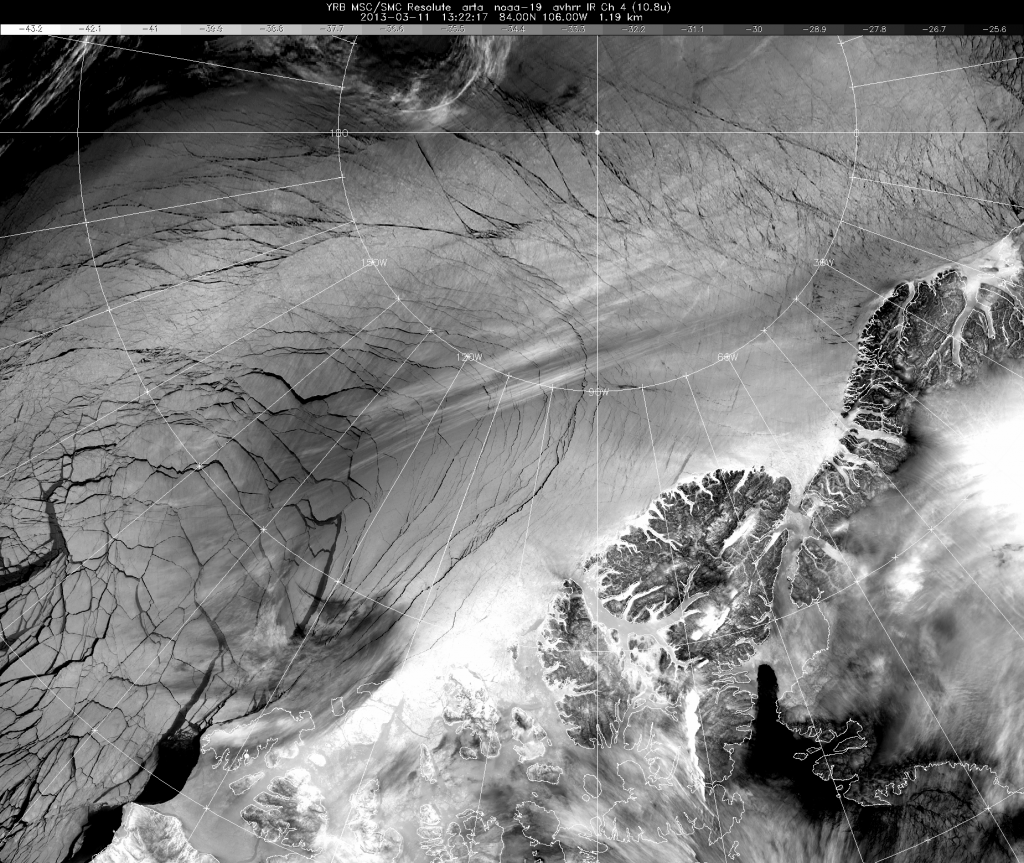
Over the next two days more cracks opened up, this time extending into the area of multi-year ice between Ellesmere Island and the North Pole:
Please note the enormous scale of the system of fractures. The image above reaches from Western Alaska on the left across to North-East Greenland and Svalbard in the top right, and includes the North Pole itself right of centre at the top. Leaving the Beaufort Sea behind for the moment, here's a close up view of those fractures north of Ellesmere Island, once again courtesy of Environment Canada:
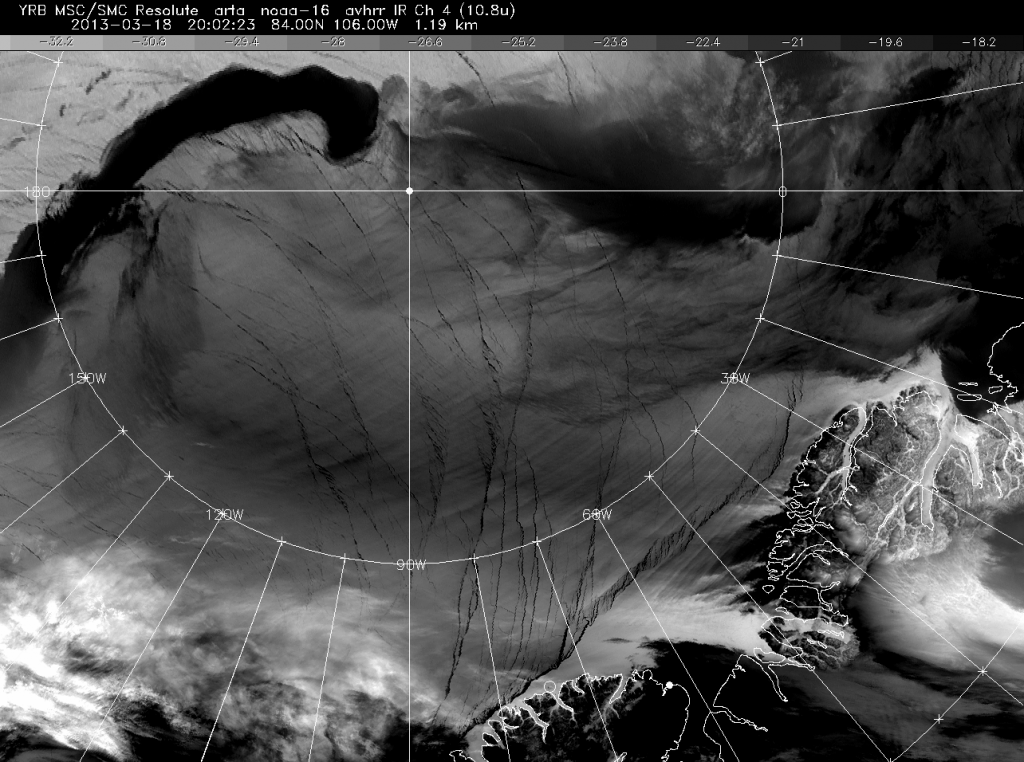
Since then another week has passed, and here is the satellite's eye view of the area of Arctic sea ice between Ellesmere Island and the North Pole this evening:
There are a lot of clouds around at the moment, but you can nonetheless see the latest set of new cracks hugging the north coast of Ellesmere Island and extending further East towards Cape Morris Jesup at the tip of northern Greenland. At the top of the picture, past the clouds, you can also make out yet more cracks arcing past the North Pole over onto the Russian side of the Arctic.
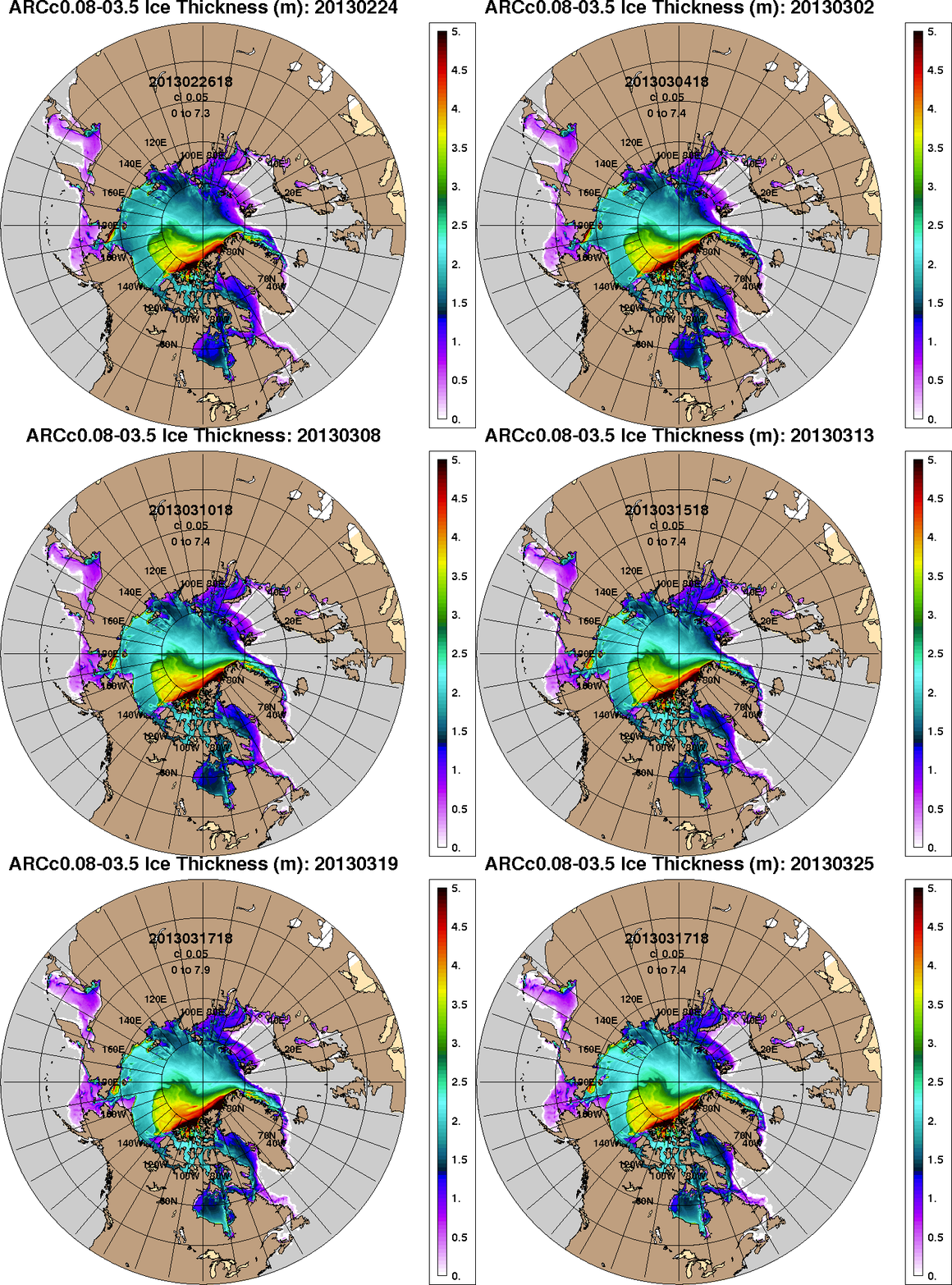
It's been said many a time that nobody knows what the future holds, but here's the US Navy's record of Arctic sea ice thickness for the last three weeks, along with their prediction for the week yet to come:
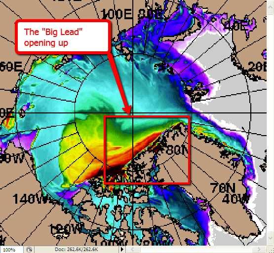
That will first of all give you some idea of the enormous area covered by the satellite images above. Then if you look closely you will see that the Navy's super-computers are predicting that the thickest ice in the Arctic, coloured from red to black in the animation, is going to separate from the north of Ellesmere Island and Greenland along the lines of these latest cracks.
Once that happens the multi-year ice will be at the mercy of the weather. If we're all lucky the winds may blow it straight back to shore. Alternatively it may be carried somewhere else entirely. Somewhere where it will ultimately be far more vulnerable to the sunlight already starting to beam down upon the Arctic Ocean once again, after the long Arctic night.
Following in Agatha's illustrious footsteps, I'll finish by quoting Alfred Lord Tennyson:
Out flew the web and floated wide
The mirror crack'd from side to side;
"The curse is come upon me," cried
The Lady of Shalott.
[Addendum March 22nd 2013]
Thanks to commenter Paul Beckwith for pointing out that the NOAA have now released their own video of the cracking progression shown in A-Team's video above, which continues up to March 18th. Here it is:
Filed under Disasters by
Comments on The Ice Cap Crack'd From Side To Side »
The day after tomorrow just happened, yesterday. My concern is for the methane that is under the ice, coming up from the sea floor. Our world is now very very different from yesterday's.
Hi Paul,
I feel sure you're aware of this already, but for other interested readers please also take a look at the perhaps aptly named "Apocalypse 4 Real" site where the latest atmospheric methane charts show that:
In this day and age it's not all still under the ice.