The Distributed Arctic Sea Ice Model
Here is an open source collaborative project to develop a Distributed Arctic Sea Ice Model
Here's the DASIM thread on the Arctic Sea Ice forum.
Here are some avenues of investigation:
Here's a monochrome flier for the Distributed Arctic Sea Ice Model project.
Here's why:
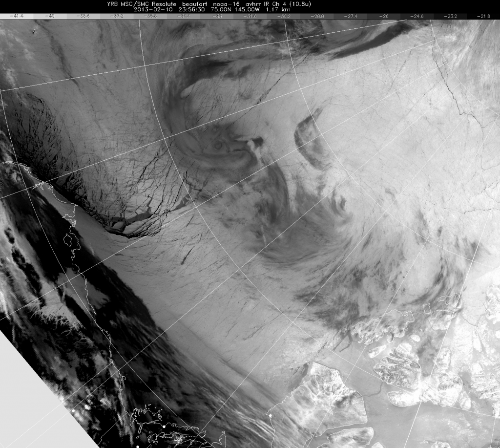
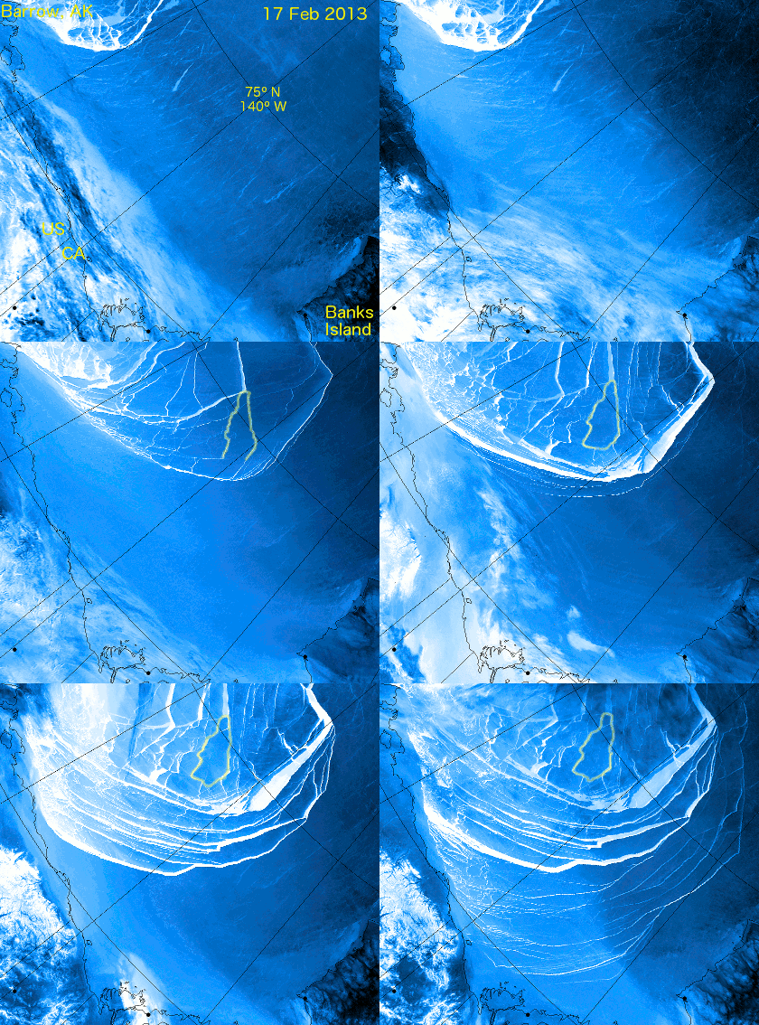
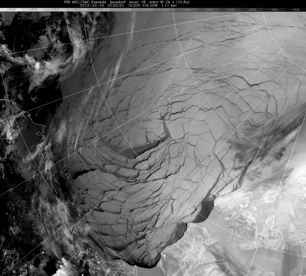
This is what one month's weather can do to the Arctic Sea Ice, during the coldest period of the year.
Before (courtesy of Environment Canada) :
During (courtesy of "A-Team" on the Arctic Sea Ice Blog) :
After (courtesy of Environment Canada) :
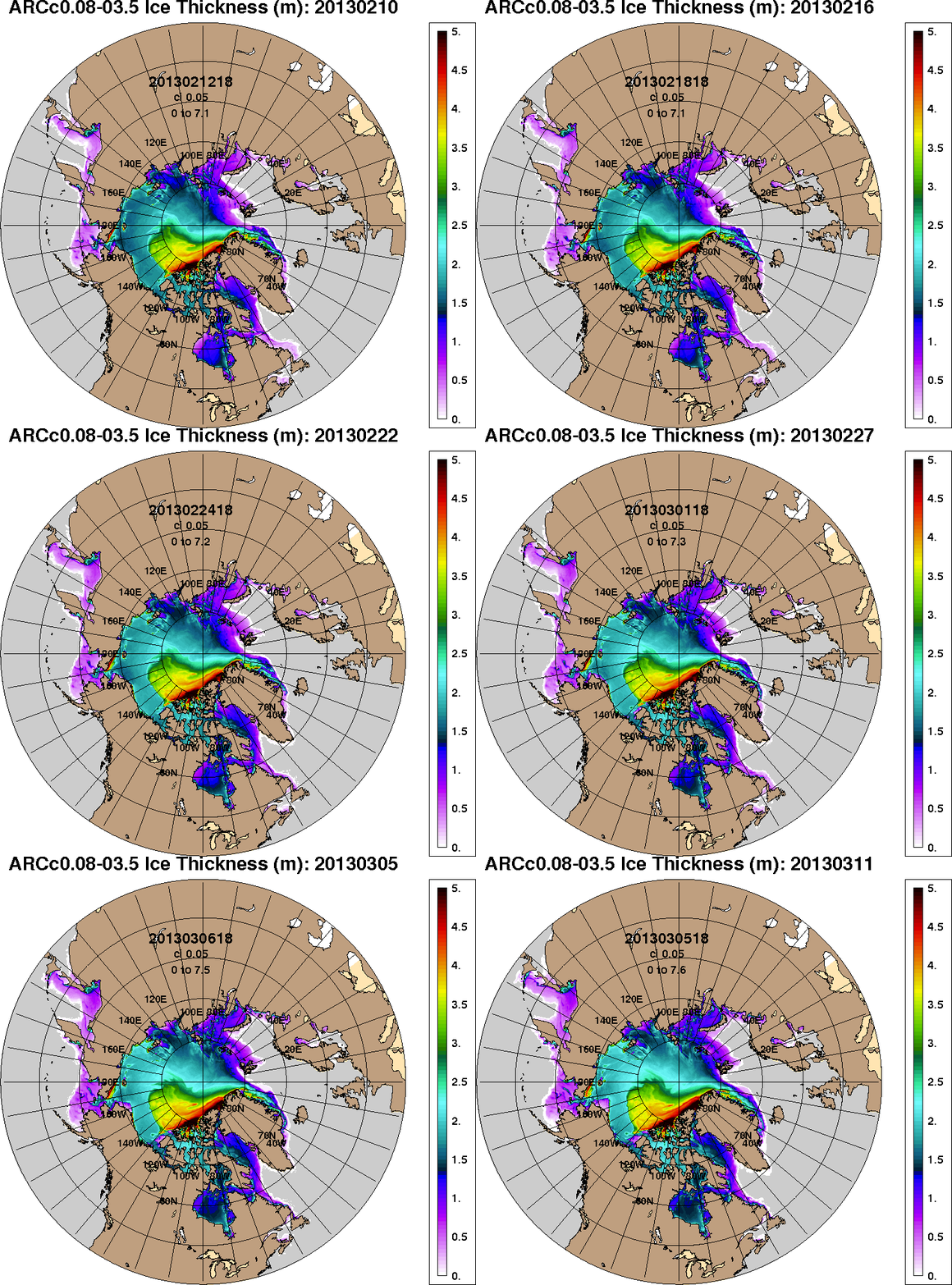
Finally, for the moment at least, here is the forecast for Arctic sea ice thickness, courtesy of the United States Navy's HYCOM/CICE model:
I call it a "forecast", but actually it's a "nowcast", and if you look very closely you may notice that the animation finishes with a forecast for today (March 11th 2013) that was actually generated on March 5th. The Navy's web site stopped updating their forecast after that, for some reason known only to themselves. Given all these uncertainties you may well wish to ask yourself some questions, such as:
What are the strengths and weaknesses of the Arctic Sea Ice?
Is this an opportunity or a threat?
What are your strengths and weaknesses?
The existing models can't or won't tell you.
Addendum – March 12th 2013.
The US Navy's sea ice forecasts are back in action this afternoon. According to Rear Admiral Jonathan White, who I discussed the problem with at The Arctic Summit, "a server was down".
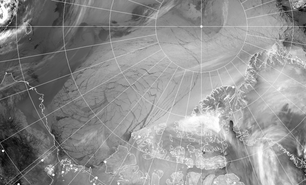
Meanwhile over the last day and a bit some more cracks have opened up, this time extending into the area of multi-year ice between Ellesmere Island and the North Pole:
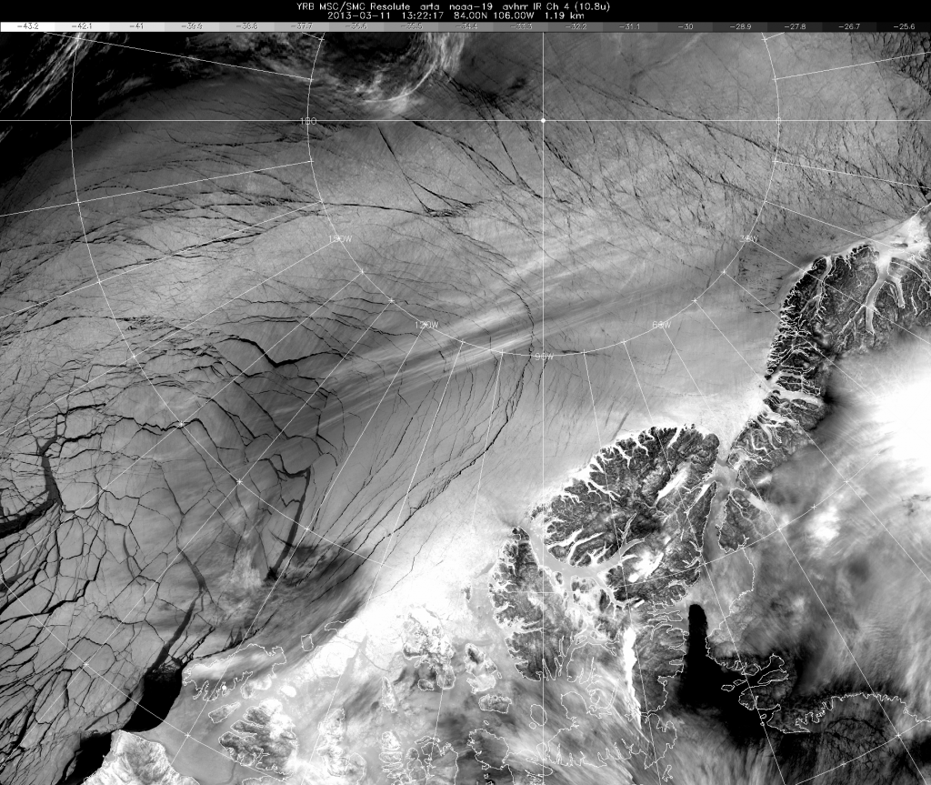
Storm clouds are now brewing over the Arctic, so the image is not as clear as previous ones. Please note however the enormous scale of the system of fractures. The image above reaches from Western Alaska on the left across to North-East Greenland and Svalbard in the top right, and includes the Pole itself right of centre at the top. Finally, for the moment at least, here's a close up view of those new fractures north of Ellesmere Island, once again courtesy of Environment Canada:
Leave a Comment