October 6, 2016
Hurricane Matthew's Storm Surge Threatens Florida
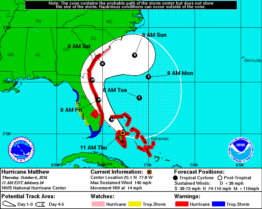
Hurricane Matthew has already caused death and devastation across the Caribbean and Bahamas, and now he's heading for Florida. Firstly here's the latest National Hurricane Center track forecast:
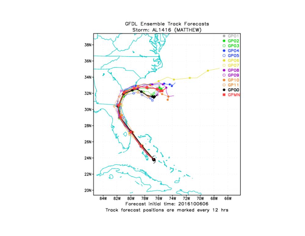
together with the current NOAA Geophysical Fluid Dynamics Laboratory ensemble forecast for Matthew:
Matthew has been gaining strength again recently:
HURRICANE MATTHEW TROPICAL CYCLONE UPDATE
NWS NATIONAL HURRICANE CENTER MIAMI FL AL142016SUMMARY OF 1200 PM EDT…1600 UTC…INFORMATION
———————————————–
LOCATION…25.3N 78.0W
ABOUT 45 MI…70 KM WNW OF NASSAU BAHAMAS
ABOUT 160 MI…260 KM SE OF WEST PALM BEACH
MAXIMUM SUSTAINED WINDS…140 MPH…220 KM/H
PRESENT MOVEMENT…NW OR 325 DEGREES AT 14 MPH…22 KM/H
MINIMUM CENTRAL PRESSURE…940 MB…27.76 INCHES
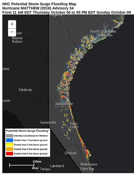
Now take a close look at the NHC's experimental storm surge prediction:
The asterisk on the legend is explained by the NHC as follows:
*Displayed flooding values indicate the water height that has about a 1-in-10 (10%) chance of being exceeded.
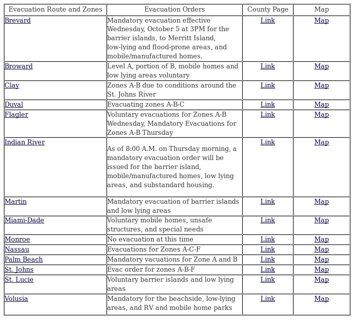
Some of the red "Greater than 9 feet above ground" areas on the storm surge map are a long way inland. Maybe that explains why there are already mandatory evacuation orders in place for the Florida coast?
No doubt there will be a huge increase in power outages as Matthew gets ever closer, but currently Florida Power reports around 13,000 customers without electricity, with another 13,000 whose power has already been restored.
Filed under Disasters by


Comments on Hurricane Matthew's Storm Surge Threatens Florida »
According to the National Hurricane Center the eyewall of Hurricane Matthew has reached the coast of South Carolina:
Here's an ABC report from Jacksonville, Florida last night, when Matthew's eye was still about 40 miles offshore:
According to the NHC's latest bulletin:
The GFDL ensemble now shows a wide range of possibilities for Matthew's future track:
The latest interim update from the NHC places the eye of Matthew directly over Myrtle Beach: