April 11, 2013
NASA Chasing Calving Ice in Western Greenland
NASA have recently been flying low over the sea ice in the Arctic on their latest IceBridge mission, measuring its thickness and recording a variety of images too, amongst other things. In our All Fools' Day quiz here on econnexus.org.uk we took a close look at the sea ice around the Disko Bay area of Western Greenland. One reason for doing that was because, as Julia Slingo who is chief scientist at the UK's Met Office pointed out only yesterday:
The Arctic is intimately linked with the North Atlantic and we know there are links, for example, in the ocean temperatures that run down the west coast of Greenland. They are very warm at the moment. Exceptionally warm!
Another reason is that below centre of those satellite images of Disko lies a glacier that goes by a variety of different names in a variety of different languages. Whether you prefer to call it Sermeq Kujalleq, Jakobshavn Isbræ or even Jakobshavn Glacier this month both we and NASA have been zooming in and taking a much closer look at the Ilulissat Icefjord and the glacier that lies at its head. According to Wikipedia Sermeq Kujalleq:
Drains 6.5% of the Greenland ice sheet and produces around 10% of all Greenland icebergs. Some 35 billion tonnes of icebergs calve off and pass out of the fjord every year. Icebergs breaking from the glacier are often so large (up to a kilometer in height) that they are too tall to float down the fjord and lie stuck on the bottom of its shallower areas, sometimes for years, until they are broken up by the force of the glacier and icebergs further up the fjord. Studied for over 250 years, Jakobshavn Glacier has helped develop our understanding of climate change and icecap glaciology.
Already this year a lot more icebergs have broken from the glacier. I first found out about the most recent of these events over on the Arctic Sea Ice Forum, where it was reported by "Yuha" on April 7th that:
The calving front is visibly retreating as seen by comparing Terra images from days 94 and 96
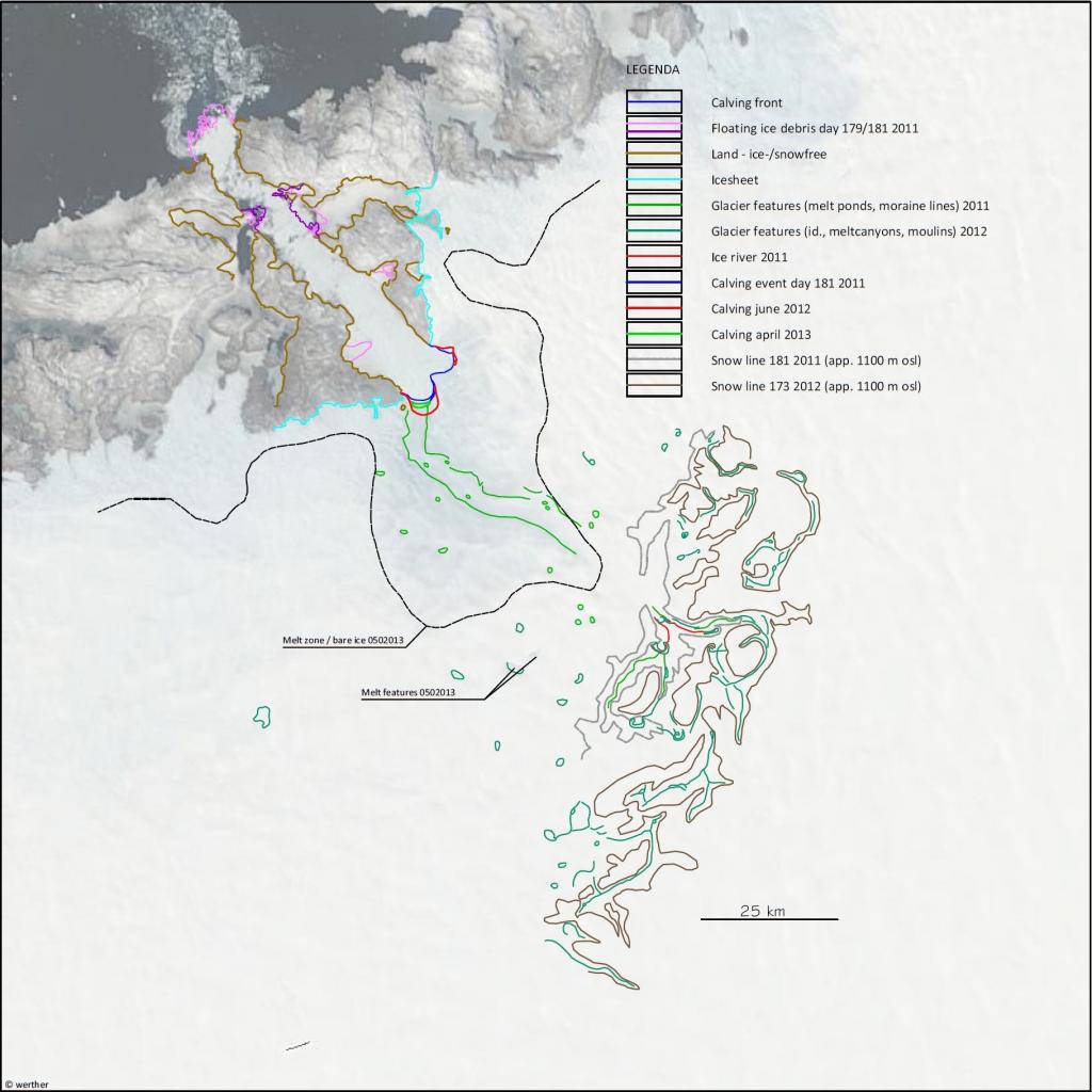
After that "Werther" swiftly produced this CAD image revealing the precise dimensions of a variety of such calving events over recent years, along with some intriguing insights into the earliest days of the 2013 Greenland ice sheet melting season:
According to Werther:
I marked a ‘melt zone/bare ice’-line and two remarkable features high up (900 m +SL). One of them is a regular melt lake that usually shows up in May. The melt zone-line nicely shows the thinning basin surrounding the glacier. There’s enough going on to fear another ravaging summer for the GIS….
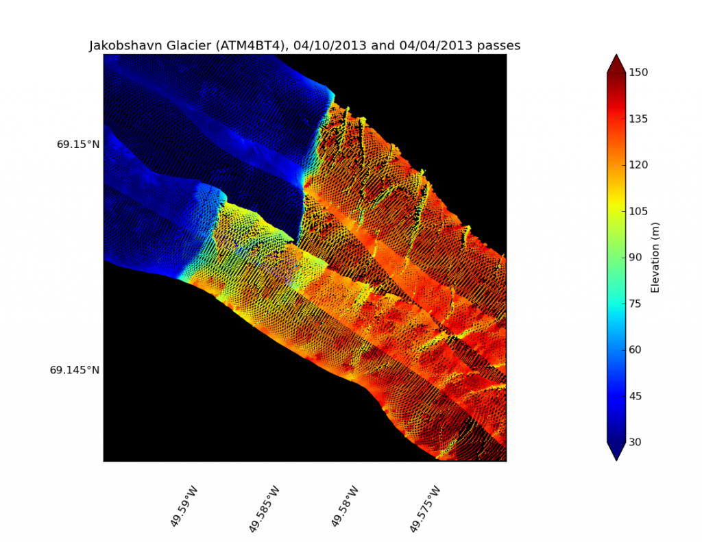
As luck would have it NASA have also been monitoring the very same calving event using their P3-B "airborne laboratory". Here's their explanation of why they've been doing that:
and here's a preliminary LIDAR image from that mission, revealing that the calving front of the Jakobshavn Glacier retreated by about 200 metres between April 4th and April 10th 2013:
To give you a feel for what NASA's P3-B pilot saw on those Jakobshavn Glacier missions, here's the view from the cockpit recorded on April 9th. This video is of a different glacier though, this time in South East Grrenland.
Finally, for the moment at least, here is what a somewhat larger calving event at the head of the Ilulissat Icefjord in 2008 looked and sounded like:
Filed under Climate by


Comments on NASA Chasing Calving Ice in Western Greenland »
thanks for posting those beautiful videos – amazing……