February 22, 2015
Britain Expects a Battering From a "Super Swell"
The Met Office has published a joint article with the Environment Agency about what it refers to as "super tides":
There has been a lot of media coverage about the potential impact of so-called ‘super tides’ which are due from today (Friday, 20 February) through to Monday.
Tides are governed by the gravitational pull of the moon and, to a lesser extent, the sun. Because the sun and moon go through different alignment, this affects the size of the tides.
When the gravitational pull of the sun and moon combine, we see larger than average tides – known as spring tides. When the gravitational pulls offset each other, we get smaller tides known as neap tides. We see two periods of spring and neap tides roughly every month.
However there is a longer cycle at work too, associated with the gravitational pull of the planets in the solar system. This means we can see additional, albeit relatively small, increases and decreases in the size of spring and neap tides over long periods of time.
We are currently at the height of those increases, so the astronomical tide is at an 18-year peak – although this is only a few centimetres bigger than a more average spring tide.
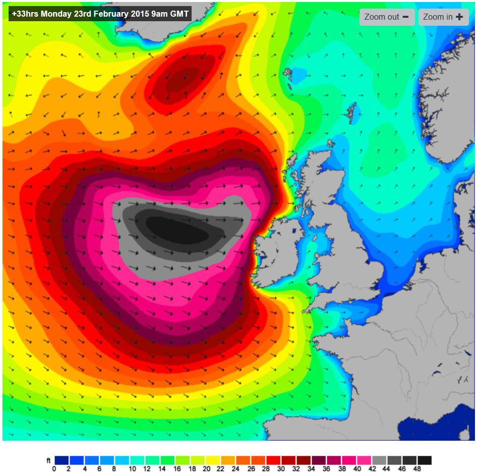
Of course then there is the weather to consider. Here's the Magic Seaweed surf forecast for 9 AM tomorrow morning (February 23rd 2015)
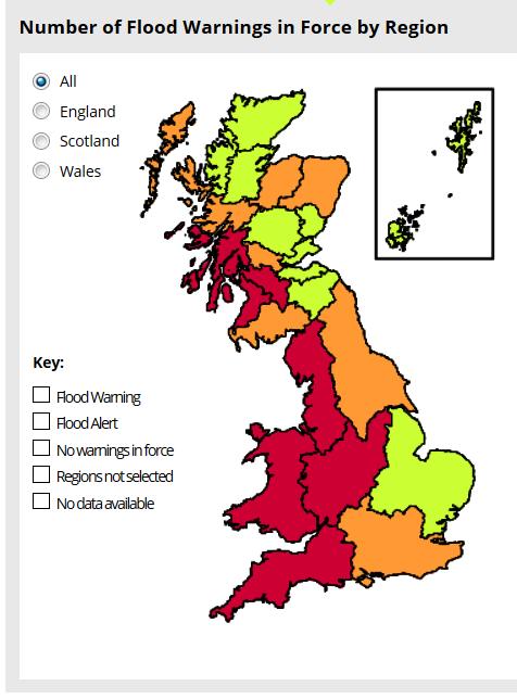
Note that the swell currently heading for Western Ireland is off the top of the maximum 50 foot scale. Here's how the Met Office's current national flood forecast looks:
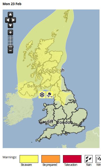
The Met Office isn't forecasting any out of the ordinary winds today, but here's their yellow wind warnings for tomorrow:
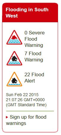
As you can see, we're not going to get the worst of the incoming storm down here in the West Country. Nonetheless the coastal battering we can expect has already resulted in red flood warnings for the North coast of Somerset, and orange alerts for a long list of other north and south coast areas. Here's how our South West flood widget looks this evening:
We confidently expect some of those orange alerts to turn red tomorrow. Here's an Environment Agency video explaining their flood warning service in more detail:
Filed under Climate by


Comments on Britain Expects a Battering From a "Super Swell" »
The Environment Agency have issued a new red flood warning for the "River Brue and Glastonbury Millstream from Lovington to Highbridge, low lying properties" at 22:23 on 22 Feb 2015. The details say:
In slightly belated news the Western Morning News reports this morning that:
In news from North Wales the Daily Post reports (with video) that:
There is now only two red flood warnings still in place in the West Country, at Porlock Weir and the tidal River Avon.
In addition there are still 3 each in Wales and North West England, but 13 in Scotland:
"Flooding is expected. Immediate action required."