August 9, 2014
Bertha Brings Flood Warnings to SW England
We've had quite a nice summer so far here in South West England but it looks as though that is about to change, temporarily at least. Bertha began life as a tropical storm east of the Antilles on August 1st 2014, over the following 2 days she passed over several Caribbean islands before briefly reaching the status of a category 1 hurricane on August 4th. The following day Bertha was downgraded to a tropical storm again, but now her remnants are bearing down on SW England. According to the Met Office at the moment:
The weather will turn wet and windy in many parts from Sunday morning, with gales perhaps severe, likely along some southern coastal and inland areas.
The Met Office has been assessing the effects of ex hurricane Bertha on the UK by using its own forecast models alongside models from other world-leading forecast centres.
At the moment it looks as though the storm will track across the southern half of the UK on Sunday before heading out into the North Sea and travelling up the eastern coast, bringing some disruption to Scotland on Monday. Much of the UK will see large rainfall totals, however their remains some uncertainty relating to the strength of the winds, which could be locally very disruptive.
We are expecting unseasonable storm force winds in the northern North Sea with the risk of 80 mile per hour plus gusts which could be dangerous for shipping / offshore operations.
We are watching very carefully and the forecast is constantly under review and subject to change.
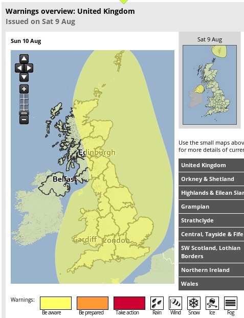
It seems as though, much like the "St. Jude day storm" last October, the likely effect on various parts of the United Kingdom won't be clear until the last minute. For the moment though, the Met Office has issued a severe weather warning for rain on Sunday covering almost the entire country:
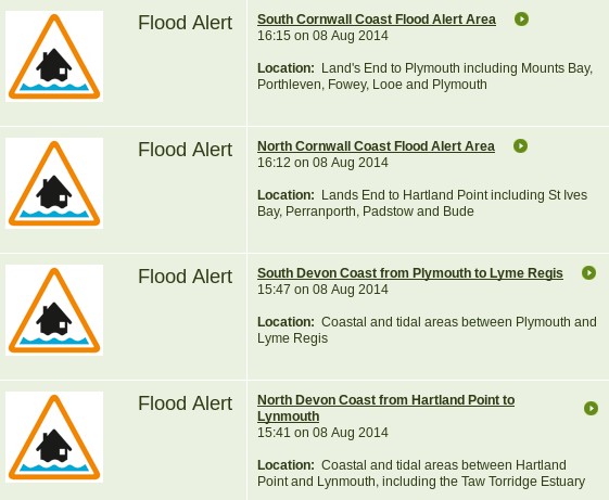
Our "flood widget" over on the right hand side of the page currently reveals a total of four flood alerts for South West England, each covering a long stretch of coast:
As you can see, together they currently include the entire coastline of Devon and Cornwall! The South Devon coast is nearest to us, and that alert states that:
There is potential for stormy coastal conditions starting on Sunday (10/08/2014) and continuing into next week. This coincides with a period of rising spring tides. The storm will create an area of low pressure, high winds and large waves which could lead to flooding for exposed seafronts starting from Sunday evenings high tide. We will continue to monitor the situation and issue updates as the weather system moves across us.
The next obvious question, to us at least, is what will the surf be like over the next couple of days. That all depends on the exact track of the storm, and nobody seems very sure about that the moment unfortunately! Here's what the Magic Seaweed UK swell forecast looks like at the moment for 12:00 tomorrow:
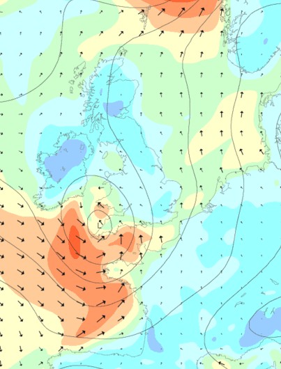
and here's the wind forecast for 06:00
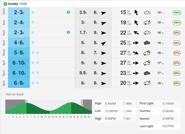
That shows offshore winds on the north coast at first light, so here's the overall surf forecast for Bude tomorrow:
Unfortunately I don't think that is sufficient to temp us to set our alarms for an early start! Of course with all the current uncertainty everything may have changed by the time the sun eventually rises tomorrow morning!
Filed under Climate by


Comments on Bertha Brings Flood Warnings to SW England »
This morning the storm seems to be tracking further north than forecast yesterday:
Now travelling across the centre of the country instead of along the south coast, the wind speeds don't really start to build until the central pressure drops over the North Sea, which ultimately falls to 978 according to GFS at the moment.
According to the BBC:
Here in the Southwest there are a couple of new flood alerts, for Poole and Christchurch harbours, but no flood warnings as yet. Here's what "ex Bertha" brought us, courtesy of the Bridford Met Site:
It's now Sunday evening, and three flood warnings have been issued for the Somerset coast:
Further afield, there are also currently 3 flood warnings in the Northeast, 1 in the Northwest and one in Wales.
It's Tuesday lunchtime, and a further 5 flood warnings have now been issued. They cover parts of the North Cornwall and North Devon coastline:
With all the water falling from the heavens recently, there have also been a few incidents of raw sewage being pumped into our coastal waters, as reported by Surfers Against Sewage: