Connecticut Light and Power – Connecticut
Connecticut Light and Power Outage Map- Connecticut
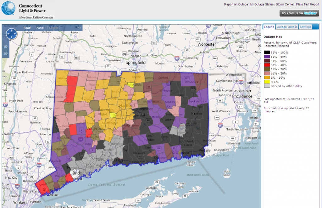
Possibly because it's currently 3:30 AM on Tuesday August 30th the CL&P online outage map is working fine and loading very quickly. Maybe they've upgraded their web servers? There's still quite a large area in the 80-100% range. Here's how it looks at the moment:
CL&P have also released a video showing how Connecticut looked from a helicopter yesterday:
According to the CL&P Twitter feed at 4 PM on Monday August 29th:
Power restored to 200,000+ customers. Nearly 800 crews at work. Substantial progress made in clearing roads and assessing damage.
According to the CL&P website on Monday August 29th:
Heavy interest in the CL&P outage map has pushed our internet capacity to 100% utilization. To ensure everyone has access to important outage information, the map will be replaced by the table showing outage information by town.
According to that table at 1:30 PM on Monday August 29th 591,094 of their customers are without electricity. To keep those customers better informed CL&P have now started a "Hurricane Irene Info" page on Facebook, as well as a Twitter page.
On Sunday August 28th Connecticut Light and Power made a video available in which their President Jeff Butler talks about their damage assessment operation:
They also reported that:
With the remnants of Hurricane Irene leaving Connecticut, about 800 CL&P and contractor line and tree crews from as far away as Florida, Ohio and Michigan are now being deployed to start the restoration process. At the peak, the storm left more than 622,000 CL&P customers without power. This sets a record, surpassing the 477,000 CL&P customers who lost power from Hurricane Gloria in 1985.

Leave a Comment